


Listar por autor "Cassiraga, Eduardo Fabián"
RiuNet: Repositorio Institucional de la Universidad Politécnica de Valencia
- RiuNet repositorio UPV
- :
- Listar por autor
JavaScript is disabled for your browser. Some features of this site may not work without it.
Buscar en RiuNet
Listar
Mi cuenta
Ayuda RiuNet
Admin. UPV
Listar por autor "Cassiraga, Eduardo Fabián"
Mostrando ítems 21-37 de 37
-
 Rodríguez Pérez, Joaquín (Universitat Politècnica de València, 2021-01-21)[ES] El mayor problema de la gestión de recursos hídricos es la irregularidad espacial, temporal y de calidad con la que aparece el recurso. La multifuncionalidad del agua provoca muchos intereses confrontados, suministro ...
 -
 Romanazzi, Pablo (Universitat Politècnica de València, 2017-11-06)This dissertation cope with unsteady state flow in a dual porosity aquifer. In our theoretical mainframe, a naturally fractured porous media saturated by a monophasic fluid (i.e. water at normal temperature and pressure ...
 -
Escrivá Benito, Laura (Universitat Politècnica de València, 2020-09-28)[ES] La contaminación ocasionada por nitratos es una de las más frecuentes en el ámbito de áreas con alta actividad agrícola. Concretamente, el acuífero de la Plana de Valencia está sometido a un alto grado de estrés hídrico ...
-
 Pérez Indoval, Ricardo (Universitat Politècnica de València, 2023-07-03)[ES] La predicción del comportamiento de los pesticidas liberados en el ambiente es necesaria para anticipar y por ende minimizar sus efectos adversos. La contaminación por pesticidas en las aguas subterráneas puede suceder ...
 -
 Citores Martínez, Íñigo (Universitat Politècnica de València, 2018-10-22)En la zona costera de la demarcación hidrográfica de la cuenca del río Júcar existen diferentes acuíferos con un gran volumen de recursos hídricos subterráneos, por lo que se consideran sistemas de gran importancia e interés ...
 -
 Fernández Urizar, Irati (Universitat Politècnica de València, 2017-10-19)[EN] The groundwater body Requena-Utiel is located in the central area of the Jucar Hydrographic demarcation, within the Jucar exploitation system (in 96,8%). The rest 3,2% belongs to the Túria exploitation system. It has ...
 -
Rodríguez Gómez, Silvia (Universitat Politècnica de València, 2017-04-25)Water is a basic element for life, so it must be protected and defended as such. Thus, it is necessary to inculcate a sustainable use and exploitation of water resources to keep them in a good state, both qualitative and ...
-
Sanz, David; Castano, Santiago; Cassiraga ., Eduardo Fabián; Sahuquillo Herráiz, Andrés; Gomez-Alday, J.J.; Peña Haro, Salvador; Calera, Alfonso (SPRINGER, 2011)The Mancha Oriental System (MOS, 7,260 km2) is one of the largest aquifers within Spain, and is encompassed by the Jucar River Basin. Over the past 30 years, socioeconomic development within the region has been largely due ...
-
 Lopez, Agustin (Universitat Politècnica de València, 2023-09-18)[ES] La masa de agua subterránea de Crevillente presenta continuidad hidrogeológica entre las demarcaciones hidrográficas del Júcar y del Segura, lo que supone una complejidad añadida en la evaluación y asignación de los ...
 -
 Pérez Membrives, Miguel Ángel (Universitat Politècnica de València, 2019-10-18)[EN] Comunidad Valenciana is a region in which a Mediterranean and dry climate predominates and in which it rains very little. Groundwater plays a very important role, since about 50% of the water consumed comes from ...
 -
 Pérez-Indoval, Ricardo; Rodrigo-Ilarri, Javier; Cassiraga, Eduardo Fabián; Rodrigo-Clavero, María-Elena (MDPI AG, 2021-04)[EN] Chlorpyrifos, Bromacil and Terbuthylazine are commonly used as insecticides and herbicides to control weeds and prevent non-desirable growth of algae, fungi and bacteria in many agricultural applications. Despite their ...
 -
 Solano-Meza, Johanna; Orjuela Yepes, David; Rodrigo-Ilarri, Javier; Cassiraga, Eduardo Fabián (Elsevier, 2019)[EN] This study presents an analysis of three models associated with artificial intelligence as tools to forecast the generation of urban solid waste in the city of Bogota, in order to learn about this type of waste's ...
 -
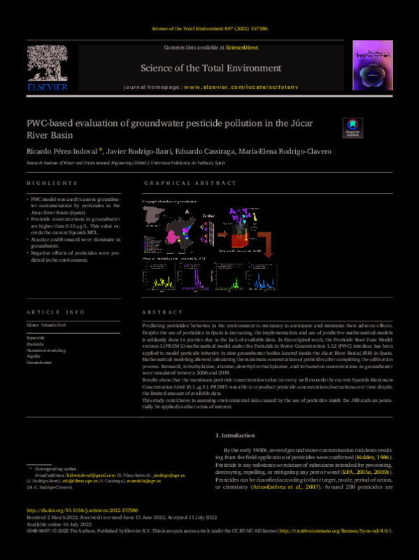 Pérez-Indoval, Ricardo; Rodrigo-Ilarri, Javier; Cassiraga, Eduardo Fabián; Rodrigo-Clavero, María-Elena (Elsevier, 2022-11-15)[EN] Predicting pesticides' behavior in the environment is necessary to anticipate and minimize their adverse effects. Despite the use of pesticides in Spain is increasing, the implementation and use of predictive mathematical ...
 -
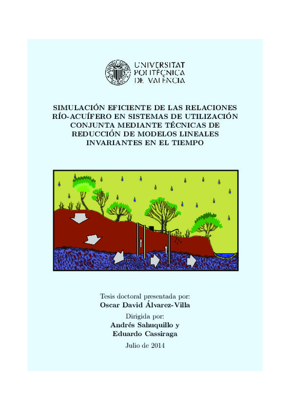 Álvarez Villa, Óscar David (Universitat Politècnica de València, 2014-09-03)En este trabajo se ha estudiado la posibilidad de usar algunas t ecnicas de reducci on para lograr una simulaci on m as e ciente del ujo subterr aneo en los acu feros contenidos en modelos de uso conjunto. As , el ...
 -
 Cassiraga, Eduardo Fabián; Gómez-Hernández, J. Jaime; Berenguer, Marc; Sempere-Torres, Daniel; Rodrigo-Ilarri, Javier (Springer-Verlag, 2021-05)[EN] Automatic interpolation of precipitation maps combining rain gauge and radar data has been done in the past but considering only the data collected at a given time interval. Since radar and rain gauge data are collected ...
 -
 Sanz Martínez, David; Vos, Jeroen; Rambags, Femke; Hoogesteger, Jaime; Cassiraga, Eduardo Fabián; Gómez-Alday, Juan José (Taylor & Francis, 2018)[EN] Groundwater flow models have been increasingly used to support policy making. A substantial amount of research has been dedicated to improving, validating and calibrating models and including stakeholders in the ...
 -
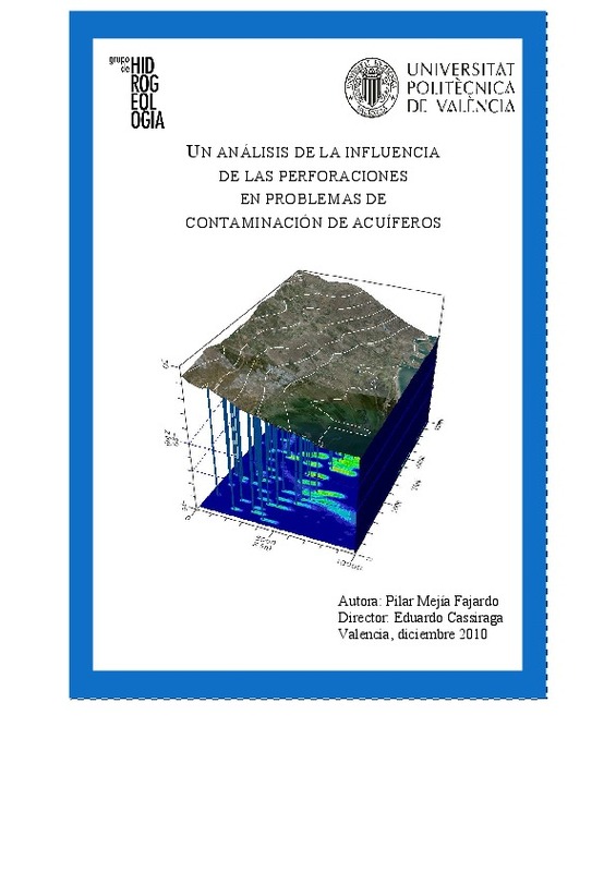 Mejía Fajardo, Amanda del Pilar (Universitat Politècnica de València, 2011-07-22)Se busca aprender y comprender como la migración de un soluto en un medio poroso saturado se ve afectada tanto por los parámetros físicos del sistema como por la existencia y estado de perforaciones. Para ello se procede ...
Mostrando ítems 21-37 de 37

Universitat Politècnica de València. Unidad de Documentación Científica de la Biblioteca (+34) 96 387 70 85 · RiuNet@bib.upv.es
El contenido de este sitio está bajo una licencia Creative Commons Reconocimiento – No Comercial – Sin Obra Derivada (by-nc-nd), salvo que se indique lo contrario.
Los metadatos de este sitio están bajo una licencia Dominio Público.
