


Multispectral Sensors in Combination with Recording Tools for Cultural Heritage Documentation
RiuNet: Repositorio Institucional de la Universidad Politécnica de Valencia
JavaScript is disabled for your browser. Some features of this site may not work without it.
Buscar en RiuNet
Listar
Mi cuenta
Estadísticas
Ayuda RiuNet
Admin. UPV


Multispectral Sensors in Combination with Recording Tools for Cultural Heritage Documentation
Mostrar el registro sencillo del ítem
Ficheros en el ítem
| dc.contributor.author | Lerma García, José Luis
|
es_ES |
| dc.contributor.author | Akasheh, Talal
|
es_ES |
| dc.contributor.author | Haddad, Naif
|
es_ES |
| dc.contributor.author | Cabrelles López, Miriam
|
es_ES |
| dc.date.accessioned | 2013-11-25T13:11:30Z | |
| dc.date.available | 2013-11-25T13:11:30Z | |
| dc.date.issued | 2011 | |
| dc.identifier.issn | 2153-053X | |
| dc.identifier.uri | http://hdl.handle.net/10251/33972 | |
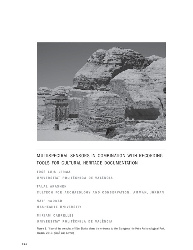
| dc.description.abstract | [EN] Documentation of cultural monuments and sites often includes a thorough analysis of their condition through time. This paper addresses the benefits of using multispectral imagery such as visible, near-infrared, and thermal infrared imagery in combination with terrestrial laser scanning to assess the state of preservation of a sandstone tomb, the Djin Block No. 9 in Petra Archaeological Park in Jordan. The combination of the different multispectral bands (visible, reflected near-infrared, and thermal infrared) and enhanced combinations of them yielded comprehensive data to analyze with maximum reliability the state of preservation of the monument with state-ofthe- art photographic and 3D surveying techniques | es_ES |
| dc.description.sponsorship | The authors would like to express their thanks for the support provided by the Agencia Espan˜ola de Cooperacio´n Internacional para el Desarrollo (AECID) to the project A/025999/ 09 and the Spanish Ministry of Science and Innovation to the project HAR2010–18620. Additional support to the Jordanian team from Societa` Italiana per Condotte d’Acqua S.p.A. is very much appreciated. | |
| dc.format.extent | 15 | es_ES |
| dc.language | Inglés | es_ES |
| dc.publisher | University of Pennsylvania Press (Penn Press) | es_ES |
| dc.relation.ispartof | Change Over Time | es_ES |
| dc.rights | Reserva de todos los derechos | es_ES |
| dc.subject.classification | INGENIERIA CARTOGRAFICA, GEODESIA Y FOTOGRAMETRIA | es_ES |
| dc.title | Multispectral Sensors in Combination with Recording Tools for Cultural Heritage Documentation | es_ES |
| dc.type | Artículo | es_ES |
| dc.identifier.doi | 10.1353/cot.2011.0015 | |
| dc.relation.projectID | info:eu-repo/grantAgreement/MAEC//A%2F025999%2F09/ES/TERMOGRAFÍA Y DOCUMENTACIÓN 3D DEL DJIN BLOCK NÚMERO 9 EN PETRA/ | es_ES |
| dc.relation.projectID | info:eu-repo/grantAgreement/MICINN//HAR2010-18620/ES/MODELADO FOTORREALISTICO TRIDIMENSIONAL AUTOMATIZADO APLICADO A LA DOCUMENTACION PATRIMONIAL/ | es_ES |
| dc.rights.accessRights | Abierto | es_ES |
| dc.contributor.affiliation | Universitat Politècnica de València. Departamento de Ingeniería Cartográfica Geodesia y Fotogrametría - Departament d'Enginyeria Cartogràfica, Geodèsia i Fotogrametria | es_ES |
| dc.description.bibliographicCitation | Lerma García, JL.; Akasheh, T.; Haddad, N.; Cabrelles López, M. (2011). Multispectral Sensors in Combination with Recording Tools for Cultural Heritage Documentation. Change Over Time. 1(2):236-250. https://doi.org/10.1353/cot.2011.0015 | es_ES |
| dc.description.accrualMethod | S | es_ES |
| dc.relation.publisherversion | http://journals.pennpress.org/strands/cot/home.htm;jsessionid=24B6F0F7EF433F74B32307B4C6A16CFD | es_ES |
| dc.description.upvformatpinicio | 236 | es_ES |
| dc.description.upvformatpfin | 250 | es_ES |
| dc.type.version | info:eu-repo/semantics/publishedVersion | es_ES |
| dc.description.volume | 1 | es_ES |
| dc.description.issue | 2 | es_ES |
| dc.relation.senia | 212679 | |
| dc.contributor.funder | Agencia Española de Cooperación Internacional para el Desarrollo | |
| dc.contributor.funder | Ministerio de Ciencia e Innovación | |
| dc.contributor.funder | Ministerio de Asuntos Exteriores y Cooperación | es_ES |
Este ítem aparece en la(s) siguiente(s) colección(ones)

Universitat Politècnica de València. Unidad de Documentación Científica de la Biblioteca (+34) 96 387 70 85 · RiuNet@bib.upv.es
El contenido de este sitio está bajo una licencia Creative Commons Reconocimiento – No Comercial – Sin Obra Derivada (by-nc-nd), salvo que se indique lo contrario.
Los metadatos de este sitio están bajo una licencia Dominio Público.
