
Listar por autor "Balaguer Beser, Ángel Antonio"
RiuNet: Repositorio Institucional de la Universidad Politécnica de Valencia
- RiuNet repositorio UPV
- :
- Listar por autor
JavaScript is disabled for your browser. Some features of this site may not work without it.
Buscar en RiuNet
Listar
Mi cuenta
Ayuda RiuNet
Admin. UPV
Listar por autor "Balaguer Beser, Ángel Antonio"
Mostrando ítems 1-20 de 43
-
Capilla Romá, Maria Teresa; Balaguer-Beser, Ángel; Nácher-Rodríguez, Beatriz; Vallés-Morán, F. J. (John Wiley & Sons, 2021-11)[EN] This article describes a high-order well-balanced central finite volume scheme for solving the coupled Exner-shallow water equations in one dimensional channels with rectangular section and variable width. Such numerical ...
-
Sánchez-García, Elena; Balaguer-Beser, Ángel; Almonacid-Caballer, Jaime; Pardo Pascual, Josep Eliseu (MDPI AG, 2019-08-12)[EN] This paper presents a new methodological process for detecting the instantaneous land-water border at sub-pixel level from mid-resolution satellite images (30 m/pixel) that are freely available worldwide. The new ...
-
Balaguer Beser, Ángel Antonio (Wiley: 12 months, 2011-07-01)This paper presents a new point value reconstruction algorithm based on average values or flux values for central Runge-Kutta schemes in the resolution of hyperbolic conservation laws. This reconstruction employs a ...
-
Capilla Romá, Maria Teresa; Balaguer Beser, Ángel Antonio (Elsevier, 2013-11)This paper is concerned with the development of high-order well-balanced central schemes to solve the shallow water equations in two spatial dimensions. A Runge Kutta scheme is applied for time discretization. A Gaussian ...
-
Capilla Romá, Maria Teresa; Balaguer Beser, Ángel Antonio (ELSEVIER SCI LTD, 2012)[EN] We present a well-balanced high-resolution non-oscillatory central finite volume scheme for solving the shallow water equations with a non-flat bottom topology. Time integration is obtained following a Runge¿Kutta ...
-
Sánchez García, Elena; Pardo Pascual, Josep Eliseu; Balaguer Beser, Ángel Antonio; Almonacid Caballer, Jaime (Copernicus Publications, 2015)[EN] A statistical analysis of the results obtained by the tool SELI (Shoreline Extraction from Landsat Imagery) is made in order to characterise the medium and long term period changes occurring on beaches. The analysis ...
-
Arcos-Villacís, María Alicia; Edo-Botella, Roberto; Balaguer-Beser, Ángel; Ruiz Fernández, Luis Ángel (MDPI AG, 2023-07)[EN] This paper presents empirical models developed through stepwise multiple linear regression to estimate the live fuel moisture content (LFMC) in a Mediterranean area. The models are based on LFMC data measured in 50 ...
-
Crespo-Peremarch, Pablo; Ruiz Fernández, Luis Ángel; Balaguer-Beser, Ángel; Estornell Cremades, Javier (Elsevier, 2018)[EN] LiDAR full-waveform (LFW) pulse density is not homogeneous along study areas due to overlap between contiguous flight stripes and, to a lesser extent, variations in height, velocity and altitude of the platform. As a ...
-
Aguilar Albán, John Henry (Universitat Politècnica de València, 2021-03-30)[ES] Para que se inicie un fuego es necesario que se produzca una reacción de combustión en la que interviene un combustible, un comburente y una aportación de calor. La disponibilidad de los combustibles y el comportamiento ...
-
Balaguer Beser, Ángel Antonio; Arcos Villacís, María Alicia (2023-06-08)En este artículo se muestra el proceso de obtención de las componentes principales usando el programa Statgraphics Centurion XVIII y el software estadístico R. Para ello se usan datos reales de índices espectrales obtenidos ...
-
Aplicación geomática para la dirección inteligente de campañas electorales: geomarketing electoral Martí Montolío, Carles (Universitat Politècnica de València, 2016-09-01)[ES] El trabajo consistirá en el desarrollo de una aplicación web orientada al geomárketing para la gestión de datos relacionados con las elecciones en el municipio de Valencia. El objetivo de la aplicación será encontrar ...
-
Pardo Pascual, Josep Eliseu; Sánchez García, Elena; Almonacid-Caballer, Jaime; Palomar-Vázquez, Jesús; Priego De Los Santos, Enrique; Fernández-Sarría, Alfonso; Balaguer-Beser, Ángel (MDPI AG, 2018)[EN] This paper evaluates the accuracy of shoreline positions obtained from the infrared (IR) bands of Landsat 7, Landsat 8, and Sentinel-2 imagery on natural beaches. A workflow for sub-pixel shoreline extraction, already ...
-
Marín Molina, Josefa; Balaguer Beser, Ángel Antonio; Felipe Román, María José; Capilla Romá, Maria Teresa (Editorial Universitat Politècnica de València, 2012-10-18)Este libro proporciona un marco general para cualquiera que desee introducirse en el estudio del Álgebra lineal. El principal objetivo del texto es presentar de forma sencilla y práctica un material con definiciones, ...
-
Sánchez García, Elena; Balaguer-Beser, Ángel; Pardo Pascual, Josep Eliseu (Elsevier, 2017)[EN] This paper describes a methodological protocol to project a terrestrial photograph of a coastal area or whatever indicator is contained on it in a georeferenced plane taking advantage of the terrestrial horizon ...
-
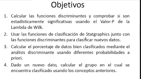
Balaguer Beser, Ángel Antonio (Universitat Politècnica de València, 2017-06-29)Se ha utilizado el programa Statgraphics Centurión y el procedimiento de análisis discriminante para clasificar nuevos datos. Para ello, se han calculado las funciones discriminantes y se ha comprobado si son estadísticamente ...
-
Jorge Monterde, Patricia (Universitat Politècnica de València, 2017-10-02)[ES] El fenómeno de la sequía debe ser percibido como un aspecto natural del clima, ya que ocurre tanto en las zonas húmedas como en las áridas de nuestro planeta. Se trata de un conjunto de condiciones climáticas que ...
-
Balaguer Beser, Ángel Antonio (Universitat Politècnica de València, 2019-06-12)Se ha utilizado el programa Statgraphics Centurion para calcular el modelo de regresión que mejor se ajusta a dos variables. Se han comparado los resultados obtenidos mediante una regresión lineal simple, mediante modelos ...
-
Balaguer Beser, Ángel Antonio; Ruiz Fernández, Luis Ángel; Hermosilla, T.; Recio Recio, Jorge Abel (Elsevier, 2010-02)In this paper, a comprehensive set of texture features extracted from the experimental semivariogram of specific image objects is proposed and described, and their usefulness for land use classification of high resolution ...
-
Gil Yepes, José Luis; Ruiz Fernández, Luis Ángel; Recio Recio, Jorge Abel; Balaguer Beser, Ángel Antonio; Hermosilla Gómez, Txomin (Elsevier, 2016-11)[EN] A new set of temporal features derived from codispersion and cross-semivariogram geostatistical functions is proposed, described, extracted, and evaluated for object-based land-use/land-cover change detection using ...
-
Andrade Sampedro, Sergio Danilo (Universitat Politècnica de València, 2018-05-31)[ES] Uno de los elementos básicos para el análisis, gestión y planificación del territorio es contar con información actual y con ello de una buena cartografía de usos de suelo. Los procesos de actualización de bases de ...
Mostrando ítems 1-20 de 43

Universitat Politècnica de València. Unidad de Documentación Científica de la Biblioteca (+34) 96 387 70 85 · RiuNet@bib.upv.es


