
Listar por autor "Garrigues Talens, Pascual"
RiuNet: Repositorio Institucional de la Universidad Politécnica de Valencia
- RiuNet repositorio UPV
- :
- Listar por autor
JavaScript is disabled for your browser. Some features of this site may not work without it.
Buscar en RiuNet
Listar
Mi cuenta
Ayuda RiuNet
Admin. UPV
Listar por autor "Garrigues Talens, Pascual"
Mostrando ítems 1-19 de 19
-
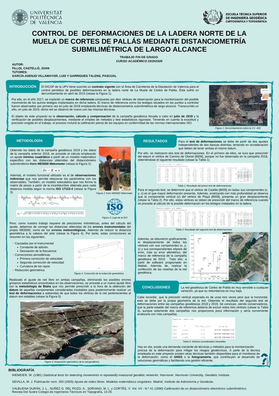
Fillol Castelló, Joan (Universitat Politècnica de València, 2020-07-30)[ES] El Departamento de Ingeniería Cartográfica, Geodesia y Fotogrametría de la UPV tiene suscrito un contrato con el Área de Carreteras de la Diputación de Valencia para el control periódico de posibles deformaciones en ...
-
Baselga Moreno, Sergio; García-Asenjo Villamayor, Luis; Garrigues Talens, Pascual (Elsevier, 2015-06)The question of determination of displacements in control networks with two or more measuring epochs is a well-known problem with broad applications to different fields of science and engineering. The standard procedure, ...
-
Baselga Moreno, Sergio; Garrigues Talens, Pascual; Berné Valero, José Luis; Anquela Julián, Ana Belén; Martín Furones, Ángel Esteban (Taylor & Francis: STM, Behavioural Science and Public Health Titles, 2011-10)Deformation monitoring in heritage buildings is an essential task for conservation and restoration studies. A vast variety of techniques can be applied assuming that a three-dimensional modelization is required: GPS (Global ...
-
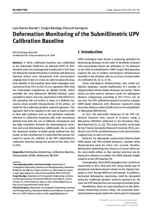
García-Asenjo Villamayor, Luis; Baselga Moreno, Sergio; Garrigues Talens, Pascual (Walter de Gruyter GmbH, 2017)[EN] A 330 m calibration baseline was established at the Universitat Politecnica de Valencia (UPV) in 2007. Absolute scale was subsequently transferred in 2012 from the Nummela Standard Baseline in Finland and distances ...
-
Barbeta Barro, Victoria Alejandra (Universitat Politècnica de València, 2019-07-30)[ES] El Instituto Cartográfico Valenciano junto con el Departamento de Ingeniería Cartográfica, Geodesia y Fotogrametría decidieron acometer un proyecto de investigación conjunto para la recuperación de los posibles vestigios ...
-
García-Asenjo Villamayor, Luis; Martínez, Laura; Baselga Moreno, Sergio; Garrigues, Pascual; Luján, Raquel (Springer, 2023-06)[EN] A high-precision geodetic reference frame was required in Cortes de Pallas (Spain) to undertake a long-term deformation monitoring project. Involving distances up to 2000 m, the aimed accuracy was 1 mm and 3 mm for ...
-
Zennouhi Messaoudi, Mustapha (Universitat Politècnica de València, 2017-09-04)[ES] El objetivo principal del presente proyecto es la determinación de las coordenadas actuales de la base de calibración de la UPV y su comparación con las originalmente obtenidas en el año 2008 en que fue implantada. ...
-
García-Asenjo Villamayor, Luis; Baselga Moreno, Sergio; Atkins, Chris; Garrigues Talens, Pascual (MDPI AG, 2021-02-06)[EN] Absolute distance determination in the open air with an uncertainty of a few tenths of a millimetre is increasingly required in many applications that involve high precision geodetic metrology. No matter the technique ...
-
Wezka, Kinga; García-Asenjo Villamayor, Luis; Próchniewicz, Dominik; Baselga Moreno, Sergio; Szpunar, Ryszard; Garrigues Talens, Pascual; Walo, Janusz; Luján, Raquel (Walter de Gruyter GmbH, 2023-04-25)[EN] At the Pieniny Klippen Belt in Poland, the novel primary reference baseline EURO5000 is required as part of the European Research project GeoMetre to both validate refractivity-compensated EDM prototypes and investigate ...
-
Stefano, Francesco Di; Cabrelles, Miriam; García-Asenjo Villamayor, Luis; Lerma, José Luis; Malinverni, Eva Savina; Baselga Moreno, Sergio; Garrigues Talens, Pascual; Pierdicca, Roberto (MDPI AG, 2020-09-29)[EN] This contribution describes the methodology applied to evaluate the suitability of a Long-Range Mobile Mapping System to be integrated with other techniques that are currently used in a large and complex landslide ...
-
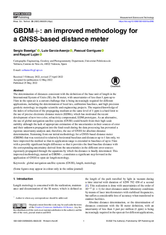
Baselga Moreno, Sergio; García-Asenjo Villamayor, Luis; Garrigues Talens, Pascual; Luján, Raquel (IOP Publishing, 2022-08-01)[EN] The determination of distances consistent with the definition of the base unit of length in the International System of Units (SI), the SI meter, with uncertainties of less than 1 ppm up to 5 km in the open air is a ...
-
Baselga Moreno, Sergio; García-Asenjo Villamayor, Luis; Garrigues Talens, Pascual; Lerma, José Luis (Cambridge University Press, 2009-10)[EN] In the integration of Global Positioning System (GPS) and Inertial Navigation System (INS), the commonly used Kalman filter provides satisfactory results if both sources of information are continuously available. ...
-
Baselga Moreno, Sergio; García-Asenjo Villamayor, Luis; Garrigues Talens, Pascual (American Society of Civil Engineers, 2014-05)Knowledge of the actual refraction coefficient is essential in leveling surveys and precise electromagnetic distance measurement reduction. The most common method followed by the surveyor for its determination is based ...
-
Débarbat, Suzanne V.; García-Asenjo Villamayor, Luis; Baselga Moreno, Sergio; Garrigues Talens, Pascual; Navarro, Xavier (American Society of Civil Engineers, 2021-08-01)[EN] This paper describes research carried out both to obtain the location and identify possible vestiges of the old geodetic benchmarks used by the expedition formed by French geodesists Arago and Biot and Spanish geodesists ...
-
Cerezuela Fernández, Carlos (Universitat Politècnica de València, 2015-09-14)[ES] Implantación de una Red Básica mediante técnicas GNSS y su densificación por métodos clásicos en el entorno de la Refinería de la compañía BP junto al puerto de Castellón.
-
García Pertusa, Jerónimo (Universitat Politècnica de València, 2015-05-19)[ES] El objetivo del presente documento es la redacción del Proyecto final de grado que lleva a la obtención del Grado en Ingeniería Geomática y Topografía en la Escuela Técnica Superior en Ingeniería Geodésica, Cartográfica ...
-
Baselga Moreno, Sergio; García-Asenjo Villamayor, Luis; Garrigues Talens, Pascual (IOP Publishing: Hybrid Open Access, 2013-05-23)Distance determination in the open air with submillimetric accuracy is a challenging task usually carried out with the use of submillimetric distancemeters and costly observation campaigns. The present paper represents ...
-
Baselga Moreno, Sergio; García-Asenjo Villamayor, Luis; Garrigues Talens, Pascual (IOP Publishing: Hybrid Open Access, 2014-08-29)The potential use of GPS technology for precise length determination is currently a topic of extensive research. A prior work was dedicated to submillimetric length determination over short baselines and under ideal ...
-
Pollinger, Florian; Baselga Moreno, Sergio; Courde, Clément; Eschelbach, Cornelia; García-Asenjo Villamayor, Luis; Garrigues, Pascual; Guillory, Joffray; Hedekvist, Per Olof; Helojärvi, Tuomas; Jokela, Jorma; Kallio, Ulla; Klügel, Thomas; Köchert, Paul; Lösler, Michael; Luján, Raquel; Meyer, Tobias; Neyezhmakov, Pavel; Pesce, Damien; Pisani, Marco; Poutanen, Markku; Prellinger, Günther; Sauthoff, Anni; Seppä, Jeremias; Truong, Daniel; Underwood, Robin; Wezka, Kinga; Wallerand, Jean Pierre; Wisniewski, Mariusz (Springer, 2023-06)[EN] We provide a survey on the joint European research project "GeoMetre", which explores novel technologies and their inclusion to existing surveying strategies to improve the traceability of geodetic reference frames ...
Mostrando ítems 1-19 de 19

Universitat Politècnica de València. Unidad de Documentación Científica de la Biblioteca (+34) 96 387 70 85 · RiuNet@bib.upv.es


