
Listar por autor "Cabezas Rabadán, Carlos"
RiuNet: Repositorio Institucional de la Universidad Politécnica de Valencia
- RiuNet repositorio UPV
- :
- Listar por autor
JavaScript is disabled for your browser. Some features of this site may not work without it.
Buscar en RiuNet
Listar
Mi cuenta
Ayuda RiuNet
Admin. UPV
Listar por autor "Cabezas Rabadán, Carlos"
Mostrando ítems 1-20 de 21
-
Sánchez-García, Elena; Palomar-Vázquez, Jesús; Pardo Pascual, Josep Eliseu; Almonacid-Caballer, J.; Cabezas-Rabadán, Carlos; Gómez Pujol, L. (Elsevier, 2020-09)[EN] Satellite images may constitute a useful source of information for coastal monitoring as long as it is possible to manage them in an efficient way and to derive precise indicators of the state of the beaches. In the ...
-
Pardo Pascual, Josep Eliseu; Palomar-Vázquez, Jesús; Cabezas-Rabadán, Carlos (Universidad de la Rioja, 2022-07-14)[EN] Beaches are spaces of paramount importance for coastal societies currently threatened by coastal erosion. Their preservation requires accurate quantification of their changes in order to understand their behavior and ...
-
Cabezas-Rabadán, Carlos; Almonacid-Caballer, Jaime; Benavente, Javier; Castelle, Bruno; Del Río, Laura; Montes, Juan; Palomar-Vázquez, Jesús; Pardo Pascual, Josep Eliseu (MDPI AG, 2024-02)[EN] The accuracy and robustness of the shoreline definition from satellite imagery on different coastal types are crucial to adequately characterising beach morphology and dynamics. However, the generic and widespread ...
-
Cabezas-Rabadán, Carlos; Rodilla, M; Pardo Pascual, Josep Eliseu; Herrera-Racionero, Paloma (Elsevier, 2019)[EN] Beach management follows a homogeneous and rigid decision-making process that tries to fulfill expectations assumed from mass tourism without really getting to know the real users' perception. Decisions are usually ...
-
Pardo Pascual, Josep Eliseu; Almonacid-Caballer, J.; Cabezas-Rabadán, Carlos; Fernández-Sarría, Alfonso; Armaroli, C.; Ciavola, P.; Montes, J.; Souto-Ceccon, P. E.; Palomar-Vázquez, Jesús (Elsevier, 2024-03)[EN] The definition of the shoreline position from satellite imagery is of great interest among coastal monitoring techniques. Understanding the reality mapped by the resulting shorelines and defining their accuracy is of ...
-
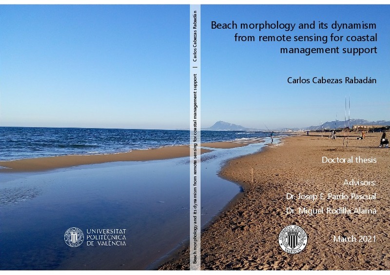
Cabezas Rabadán, Carlos (Universitat Politècnica de València, 2021-04-08)[ES] Las playas son espacios costeros que desarrollan numerosas funciones ambientales. Éstas proporcionan importantes beneficios a la sociedad y a las comunidades costeras, entre las que destacan la función ecológica, el ...
-
Cabezas-Rabadán, Carlos; Pardo Pascual, Josep Eliseu; Palomar-Vázquez, Jesús; Fernández-Sarría, Alfonso (Elsevier, 2019-11-15)[EN] Shoreline position can be efficiently extracted with subpixel accuracy frommid-resolution satellite imagery using tools as SHOREX. However, it is necessary to develop procedures for deriving descriptors of the beach ...
-
Cabezas-Rabadán, Carlos; Pardo Pascual, Josep Eliseu; Palomar-Vázquez, Jesús (MDPI AG, 2021-07)[EN] Sediment grain size is a fundamental parameter conditioning beach-face morphology and shoreline changes. From remote sensing data, an efficient definition of the shoreline position as the water-land interface may allow ...
-
Cabezas-Rabadán, Carlos; Pardo Pascual, Josep Eliseu; Almonacid-Caballer, Jaime; Rodilla, M (Elsevier, 2019-09)[EN] This work shows a continuous and regional monitoring of the beach width and how to link it with the recreational function of these spaces. Shorelines automatically derived from Landsat 8 satellite were employed for ...
-
Pardo Pascual, Josep Eliseu; Palomar-Vázquez, Jesús; Cabezas-Rabadán, Carlos (Universitat de València, 2022)[ES] Las playas son espacios de suma importancia ecosistémica y socioeconómica, en numerosas ocasiones amenazados por procesos erosivos que ponen en riesgo su sostenibilidad. Este es el caso de la costa valenciana, en la ...
-
Palomar-Vázquez, Jesús; Cabezas-Rabadán, Carlos; Castañeda, Carmen; Gracia, F. Javier; Fernández-Sarría, Alfonso; Priego De Los Santos, Enrique; Pons Crespo, Ramón; Pardo Pascual, Josep Eliseu (Elsevier, 2022-12)[EN] Lakes with strong variations in their water coverage may act as in dicators of different natural phenomena. Recent techniques for the extraction of Satellite-Derived Shorelines (SDSs) with subpixel accuracy are ...
-
Pardo-Pascual, Josep E.; Cabezas-Rabadán, Carlos; Palomar-Vázquez, Jesús; Fernández-Sarría, Alfonso (Editorial Universitat Politècnica de València, 2023-01-27)[EN] Beaches are extremely dynamic natural environments that experience significant variations at different spatial and temporal scales. The processes of appearance and maintenance of morphological features as the beach ...
-
Cabezas-Rabadán, Carlos; Pardo Pascual, Josep Eliseu; Almonacid-Caballer, Jaime; Palomar-Vázquez, Jesús; Fernández-Sarría, Alfonso (Buletin Asociacion Geografos Espanoles, 2019)[EN] Large-scale and continuous monitoring of morphological changes on beaches is of great interest for coastal management. Shoreline positions were extracted with the system SHOREX on multiple dates on three beaches of ...
-
Pardo Pascual, Josep Eliseu; Cabezas-Rabadán, Carlos; Palomar-Vázquez, Jesús (FUNDICOT, 2021)[ES] Las playas son espacios naturales de gran importancia socioambiental amenazados por procesos erosivos. Los satélites Landsat 8 y Sentinel 2 ofrecen gran potencial para la monitorización costera. Sus imágenes, gratuitas, ...
-
Navarro Leblond, Manon (Universitat Politècnica de València, 2024-09-24)[ES] Los ecosistemas dunares son sistemas altamente dinámicos que juegan un papel clave en la estabilización de la costa, por lo que resulta esencial llevar un registro preciso de los cambios que experimentan y monitorizar ...
-
Cabezas Rabadán, Carlos (Universitat Politècnica de València, 2013-11-15)Los municipios de Gandia y l¿Orxa se encontraron en el pasado unidos por la línea férrea Alcoi - Gandia. El trayecto, especialmente en el tramo l¿Orxa - Gandia, cuenta con un gran atractivo paisajístico, histórico y ...
-
Cabezas Rabadán, Carlos (Universitat Politècnica de València, 2014-11-20)Las playas valencianas atraen a un gran número de turistas y visitantes, con diferentes intereses y percepciones que deben ser tenidos en cuenta al realizar la gestión de estas zonas litorales. En este trabajo se busca ...
-
Cabezas-Rabadán, Carlos; Pardo Pascual, Josep Eliseu; Palomar-Vázquez, Jesús; Roch-Talens, A.; Guillén, J. (Elsevier, 2024-03)[EN] Storms and extremely energetic events may significantly impact the form and structure of beaches, and so cause erosive processes and coastal damages. Efficient management actions require an updated and accurate knowledge ...
-
Palomar-Vázquez, Jesús; Pardo Pascual, Josep Eliseu; Almonacid-Caballer, Jaime; Cabezas-Rabadán, Carlos (MDPI AG, 2023-06)[EN] SAET (Shoreline Analysis and Extraction Tool) is a novel open-source tool to enable the completely automatic detection of shoreline position changes using the optical imagery acquired by the Sentinel-2 and Landsat 8 ...
-
Palomar-Vázquez, Jesús; Cabezas-Rabadán, Carlos; Fernández-Sarría, Alfonso; Priego De Los Santos, Enrique; Pons Crespo, Ramón; Pardo Pascual, Josep Eliseu (Elsevier, 2022-08)[EN] Gallocanta is the largest well-preserved saline lake in Western Europe, included in the Ramsar List. Associated with its shallow morphology, the lake undergoes strong variations in its water surface extent along time ...
Mostrando ítems 1-20 de 21

Universitat Politècnica de València. Unidad de Documentación Científica de la Biblioteca (+34) 96 387 70 85 · RiuNet@bib.upv.es


