
Listar por palabra clave "Forest inventory"
RiuNet: Repositorio Institucional de la Universidad Politécnica de Valencia
- RiuNet repositorio UPV
- :
- Listar por palabra clave
JavaScript is disabled for your browser. Some features of this site may not work without it.
Buscar en RiuNet
Listar
Mi cuenta
Ayuda RiuNet
Admin. UPV
Listar por palabra clave "Forest inventory"
Mostrando ítems 1-9 de 9
-
Mauro, Francisco; Monleón, V. J.; Temesgen, H.; Ruiz Fernández, Luis Ángel (Canadian Science Publishing, 2017)[EN] Accounting for spatial correlation of LiDAR model errors can improve the precision of model-based estimators. To estimate spatial correlation, sample designs that provide close observations are needed, but their ...
-
Ruiz Fernández, Luis Ángel; Hermosilla, T.; Mauro, Francisco; Godino, Miguel (MDPI AG, Basel, Switzerland, 2014)This paper assesses the combined effect of field plot size and LiDAR density on the estimation of four forest structure attributes: volume, total biomass, basal area and canopy cover. A total of 21 different plot sizes ...
-
Vinué-Visús, David; Ruiz-Peinado, Ricardo; Fuente, David; Oliver Villanueva, José Vicente; Coll-Aliaga, Eloína; LERMA ARCE, VICTORIA (MDPI AG, 2022-05)[EN] In this contribution, we assessed the biomass and carbon stock of a post-fire area covered by a young oak coppice of Quercus pyrenaica Willd. associated with shrubs, mainly of Cistus laurifolius L. This area was burned ...
-
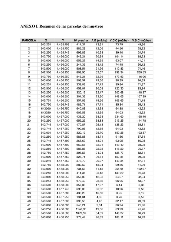
Fuertes Esteban, Guillermo (Universitat Politècnica de València, 2024-10-15)[ES] El presente trabajo tiene el objetivo de determinar los valores de la primera medición de una red de parcelas permanentes de Pinus halepensis Mill. en el Alto Palancia y la metodología de trabajo seguida en su inventario ...
-
Urrecho Torres, Javier (Universitat Politècnica de València, 2021-10-06)[ES] El primer paso para una adecuada ordenación forestal es la cuantificación de las existencias de biomasa. Esto se realiza típicamente mediante inventarios forestales en general largos y costosos, si bien existen ...
-
Igual Villanueva, Javier (Universitat Politècnica de València, 2016-09-30)[ES] El Monte de Utilidad Pública nº 246, denominado ¿Patio de Enmedio del Rey Don Jaime¿ o ¿Patio de Teruel", se encuentra localizado en el término municipal de Albarracín (Teruel) y tiene una superficie de 358 ha. Es una ...
-
Sánchez Alberola, Jesús (Universitat Politècnica de València, 2015-09-02)[EN] Forest management allows a sustainable use of its resources. Forest Inventory is an important tool to be applied for the efficient management of these areas facilitating the estimation of forest attributes. The highest ...
-
Villarroya Gargallo, Jaime (Universitat Politècnica de València, 2024-10-14)[ES] Este Trabajo fin de grado llevará a cabo la elaboración de un Plan Técnico de Gestión Forestal (PTGF) en una finca (78 ha), afectada por un incendio forestal en 1994 y de titularidad privada, situada en el municipio ...
-
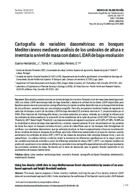
Guerra-Hernández, J.; Tomé, M.; González-Ferreiro, E. (Universitat Politècnica de València, 2016-06-27)[EN] This study reports progress in forest inventory methods involving the use of low density airborne LiDAR data and an area-based approach (ABA). It also emphasizes the usefulness of the Spanish countrywide LiDAR dataset ...
Mostrando ítems 1-9 de 9

Universitat Politècnica de València. Unidad de Documentación Científica de la Biblioteca (+34) 96 387 70 85 · RiuNet@bib.upv.es


