JavaScript is disabled for your browser. Some features of this site may not work without it.
Buscar en RiuNet
Listar
Mi cuenta
Estadísticas
Ayuda RiuNet
Admin. UPV
Documentation of cultural heritage using 3D laser scanning and close-range photogrammetry
Mostrar el registro sencillo del ítem
Ficheros en el ítem
| dc.contributor.advisor | Balaguer Puig, Matilde
|
es_ES |
| dc.contributor.author | Avila Forero, Ginna Paola
|
es_ES |
| dc.date.accessioned | 2019-09-27T07:20:15Z | |
| dc.date.available | 2019-09-27T07:20:15Z | |
| dc.date.created | 2019-09-11 | |
| dc.date.issued | 2019-09-27 | es_ES |
| dc.identifier.uri | http://hdl.handle.net/10251/126477 | |
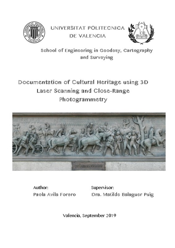
| dc.description.abstract | [EN] The rapid loss and damage of cultural heritage assets introduces the need to document important structures, so as to preserve historic memorials. A Detailed 3D model of them serves not only as a visually compelling representation but also as an approach to obtain accurate measurements, analysis and even restoration. Laser Scanning and Close-Range Photogrammetry are the two 3D data aquisition techniques that were applied on a currently preserved monument that represents the Battle of Brienne, located on the Jubiläumssäule¿s northern frieze in Schloßplatz, Stuttgart. This paper documents the process from the acquisition of high resolution data of the frieze, the methodology and equipments used, and moreover, the models and results, and some recommendations for future works in the same field. | es_ES |
| dc.description.abstract | [ES] La rápida pérdida y daño de los bienes del patrimonio cultural crea la necesidad de documentar estructuras importantes, a fin de preservar monumentos históricos. Un modelo 3D detallado sirve no solo como una representación visualmente atractiva sino también como una vía para obtener mediciones precisas, análisis e incluso restauración. El escaneo láser y la fotogrametría de objeto cercano son las dos técnicas de adquisición de datos 3D que se aplicaron en un monumento actualmente preservado que representa la batalla de Brienne en un friso ubicado en la fachada norte de la columna Jubiläumssäule en Schloßplatz, Stuttgart. Este trabajo documenta el proceso de modelización 3D del friso, desde la adquisición de datos de alta resolución, la metodología y equipos empleados, los resultados y los modelos obtenidos, y algunas recomendaciones para trabajos futuros en el mismo campo. | es_ES |
| dc.format.extent | 72 | es_ES |
| dc.language | Inglés | es_ES |
| dc.publisher | Universitat Politècnica de València | es_ES |
| dc.rights | Reconocimiento - Sin obra derivada (by-nd) | es_ES |
| dc.subject | Cultural heritage | es_ES |
| dc.subject | Laser scanner | es_ES |
| dc.subject | Photogrammetry | es_ES |
| dc.subject | Close-Range Photogrammetry | es_ES |
| dc.subject | 3D reconstruction | es_ES |
| dc.subject | Fotogrametría de objeto cercano | es_ES |
| dc.subject | Láser escáner | es_ES |
| dc.subject | Fotogrametría | es_ES |
| dc.subject | Patrimonio cultural | es_ES |
| dc.subject | Modelización 3D | es_ES |
| dc.subject.classification | INGENIERIA CARTOGRAFICA, GEODESIA Y FOTOGRAMETRIA | es_ES |
| dc.subject.other | Grado en Ingeniería en Geomática y Topografía-Grau en Enginyeria Geomàtica i Topografia | es_ES |
| dc.title | Documentation of cultural heritage using 3D laser scanning and close-range photogrammetry | es_ES |
| dc.title.alternative | Documentación del patrimonio cultural mediante escaner láser 3D y fotogrametría de objeto cercano | es_ES |
| dc.type | Proyecto/Trabajo fin de carrera/grado | es_ES |
| dc.rights.accessRights | Abierto | es_ES |
| dc.contributor.affiliation | Universitat Politècnica de València. Departamento de Ingeniería Cartográfica Geodesia y Fotogrametría - Departament d'Enginyeria Cartogràfica, Geodèsia i Fotogrametria | es_ES |
| dc.contributor.affiliation | Universitat Politècnica de València. Escuela Técnica Superior de Ingeniería Geodésica, Cartográfica y Topográfica - Escola Tècnica Superior d'Enginyeria Geodèsica, Cartogràfica i Topogràfica | es_ES |
| dc.description.bibliographicCitation | Avila Forero, GP. (2019). Documentation of cultural heritage using 3D laser scanning and close-range photogrammetry. Universitat Politècnica de València. http://hdl.handle.net/10251/126477 | es_ES |
| dc.description.accrualMethod | TFGM | es_ES |
| dc.relation.pasarela | TFGM\90323 | es_ES |
Este ítem aparece en la(s) siguiente(s) colección(ones)
-
ETSIGCT - Trabajos académicos [494]
Escuela Técnica Superior de Ingeniería Geodésica, Cartográfica y Topográfica


