JavaScript is disabled for your browser. Some features of this site may not work without it.
Buscar en RiuNet
Listar
Mi cuenta
Estadísticas
Ayuda RiuNet
Admin. UPV
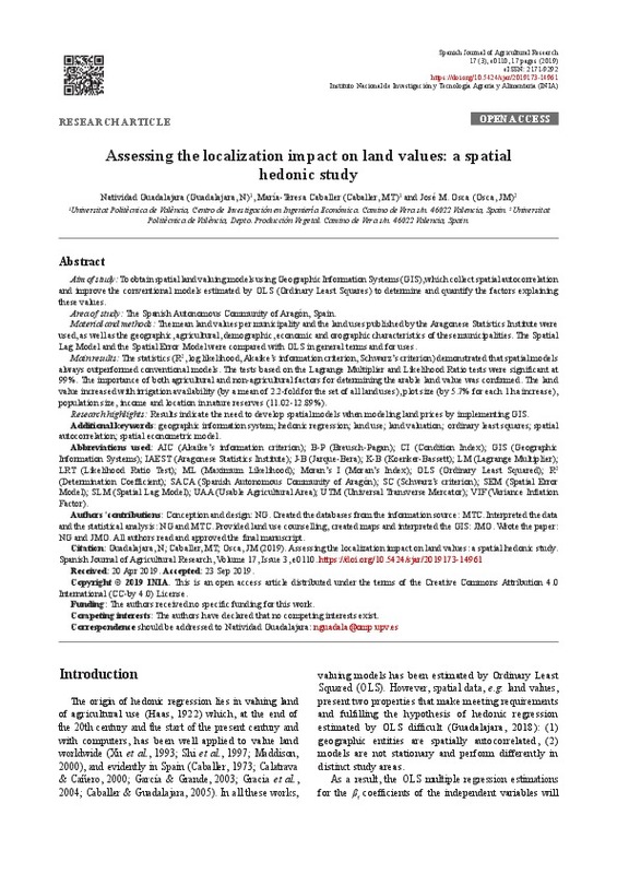
Assessing the localization impact on land values: a spatial hedonic study
Mostrar el registro sencillo del ítem
Ficheros en el ítem
| dc.contributor.author | Guadalajara Olmeda, María Natividad
|
es_ES |
| dc.contributor.author | Caballer, María-Teresa
|
es_ES |
| dc.contributor.author | Osca Lluch, José María
|
es_ES |
| dc.date.accessioned | 2020-07-14T03:31:16Z | |
| dc.date.available | 2020-07-14T03:31:16Z | |
| dc.date.issued | 2019 | es_ES |
| dc.identifier.uri | http://hdl.handle.net/10251/147919 | |
| dc.description.abstract | [EN] The importance of spatial effects on arable land values has been well accepted in recent years. Consequently, the objective of the present study was to obtain spatial land valuing models using Geographic Information Systems (GIS), which collect spatial autocorrelation and improve the conventional models estimated by OLS (Ordinary Least Squares) to determine and quantify the factors explaining these values. To do so, the mean land values per municipality and the land uses published by the Aragonese Statistics Institute were used, as well as the geographic, agricultural, demographic, economic and orographic characteristics of these municipalities. The Spatial Lag Model and the Spatial Error Model were compared with OLS in general terms and for uses. The statistics (R2, log likelihood, Akaike¿s information criterion, Schwarz¿s criterion) demonstrated that spatial models always outperformed conventional models. The tests based on the Lagrange Multiplier and Likelihood Ratio tests were significant at 99%. The importance of both agricultural and non-agricultural factors for determining the arable land value was confirmed. The land value increased with irrigation availability (by a mean of 2.2-fold for the set of all land uses), plot size (by 5.7% for each 1 ha increase), population size, income and location in nature reserves (11.02-12.89%). This indicates the need to develop spatial models when modeling land prices by implementing GIS. | es_ES |
| dc.language | Inglés | es_ES |
| dc.publisher | Instituto Nacional de Investigacion y Tecnologia Agraria y Alimentaria | es_ES |
| dc.relation.ispartof | Spanish Journal of Agricultural Research (Online) | es_ES |
| dc.rights | Reconocimiento (by) | es_ES |
| dc.subject | Spatial autocorrelation | es_ES |
| dc.subject | Land valuation | es_ES |
| dc.subject | Land use | es_ES |
| dc.subject | Geographic information system | es_ES |
| dc.subject | Hedonic regression | es_ES |
| dc.subject | Ordinary least squares | es_ES |
| dc.subject | Spatial econometric model | es_ES |
| dc.subject.classification | ECONOMIA, SOCIOLOGIA Y POLITICA AGRARIA | es_ES |
| dc.subject.classification | PRODUCCION VEGETAL | es_ES |
| dc.title | Assessing the localization impact on land values: a spatial hedonic study | es_ES |
| dc.type | Artículo | es_ES |
| dc.identifier.doi | 10.5424/sjar/2019173-14961 | es_ES |
| dc.rights.accessRights | Abierto | es_ES |
| dc.contributor.affiliation | Universitat Politècnica de València. Departamento de Economía y Ciencias Sociales - Departament d'Economia i Ciències Socials | es_ES |
| dc.contributor.affiliation | Universitat Politècnica de València. Departamento de Producción Vegetal - Departament de Producció Vegetal | es_ES |
| dc.description.bibliographicCitation | Guadalajara Olmeda, MN.; Caballer, M.; Osca Lluch, JM. (2019). Assessing the localization impact on land values: a spatial hedonic study. Spanish Journal of Agricultural Research (Online). 17(3). https://doi.org/10.5424/sjar/2019173-14961 | es_ES |
| dc.description.accrualMethod | S | es_ES |
| dc.relation.publisherversion | https://doi.org/10.5424/sjar/2019173-14961 | es_ES |
| dc.type.version | info:eu-repo/semantics/publishedVersion | es_ES |
| dc.description.volume | 17 | es_ES |
| dc.description.issue | 3 | es_ES |
| dc.identifier.eissn | 2171-9292 | es_ES |
| dc.relation.pasarela | S\392336 | es_ES |


