JavaScript is disabled for your browser. Some features of this site may not work without it.
Buscar en RiuNet
Listar
Mi cuenta
Estadísticas
Ayuda RiuNet
Admin. UPV
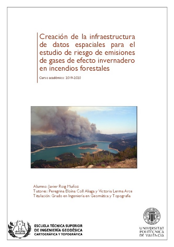
Creación de la infraestructura de datos espaciales para el estudio de riesgo de emisiones de gases de efecto invernadero en incendios forestales
Mostrar el registro sencillo del ítem
Ficheros en el ítem
| dc.contributor.advisor | Coll Aliaga, Peregrina Eloína
|
es_ES |
| dc.contributor.advisor | Lerma Arce, Victoria
|
es_ES |
| dc.contributor.author | Roig Muñoz, Javier
|
es_ES |
| dc.date.accessioned | 2021-01-07T12:04:54Z | |
| dc.date.available | 2021-01-07T12:04:54Z | |
| dc.date.created | 2020-12-14 | |
| dc.date.issued | 2021-01-07 | es_ES |
| dc.identifier.uri | http://hdl.handle.net/10251/158325 | |
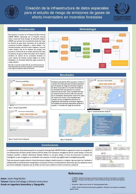
| dc.description.abstract | [ES] El objetivo de este proyecto es generar, adaptar y estructurar la base cartográfica del modelo del riesgo de emisiones de gases de efecto invernadero del proyecto europeo Interreg SUDOE REMAS. Se elaborará una infraestructura de datos espaciales para el repositorio de toda la cartografía existente en el proyecto para organizarla y almacenarla en una manera estructurada y fácil de localizar para las regiones participantes. Para ello, se generará un modelo de datos de toda la cartografía del proyecto y se adaptará al cumplimiento de la normativa INSPIRE. Finalmente, con la cartografía homogénea resultante se creará, configurará y gestionará la IDE del proyecto. Con ello se contribuirá a mejorar la coordinación y eficacia de los planes de prevención y restauración que incluirán la gestión del riesgo de emisiones de GEI en las regiones SUDOE frente a los impactos del cambio climático. | es_ES |
| dc.description.abstract | [EN] The objective of this project is generating, adapt, and the structuring the cartographic base from the model of emission risk of the greenhouse gases from the European project Interreg SUDOE REMAS. An infrastructure of spatial data will be developed for the repository of all the existent cartography of the project to organize and store in a structured and easy way to found it for the participants regions. For this will be generated a data model for the available cartography in the project and will be adapt to compliance with INSPIRE regulations. Finally, with a homogeneous mapping will be created, configurated and managed the SDI of the project. With this it will contribute to improve the coordination and efficiency of the plans of prevention and restauration which will include the management of the risk of emissions from greenhouse gases in the SUDOE regions in front of the climate change impacts. | es_ES |
| dc.format.extent | 87 | es_ES |
| dc.language | Español | es_ES |
| dc.publisher | Universitat Politècnica de València | es_ES |
| dc.rights | Reserva de todos los derechos | es_ES |
| dc.subject | Cambio climático | es_ES |
| dc.subject | Gases de efecto invernadero (GEI) | es_ES |
| dc.subject | Incendios forestales | es_ES |
| dc.subject | Cartografía | es_ES |
| dc.subject | IDE | es_ES |
| dc.subject | Proyecto REMAS | es_ES |
| dc.subject | SDI | es_ES |
| dc.subject | Programa SUDOE | es_ES |
| dc.subject | Greenhouse gases | es_ES |
| dc.subject | Cartography | es_ES |
| dc.subject.classification | INGENIERIA CARTOGRAFICA, GEODESIA Y FOTOGRAMETRIA | es_ES |
| dc.subject.other | Grado en Ingeniería en Geomática y Topografía-Grau en Enginyeria Geomàtica i Topografia | es_ES |
| dc.title | Creación de la infraestructura de datos espaciales para el estudio de riesgo de emisiones de gases de efecto invernadero en incendios forestales | es_ES |
| dc.type | Proyecto/Trabajo fin de carrera/grado | es_ES |
| dc.rights.accessRights | Abierto | es_ES |
| dc.contributor.affiliation | Universitat Politècnica de València. Departamento de Ingeniería Cartográfica Geodesia y Fotogrametría - Departament d'Enginyeria Cartogràfica, Geodèsia i Fotogrametria | es_ES |
| dc.contributor.affiliation | Universitat Politècnica de València. Escuela Técnica Superior de Ingeniería Geodésica, Cartográfica y Topográfica - Escola Tècnica Superior d'Enginyeria Geodèsica, Cartogràfica i Topogràfica | es_ES |
| dc.description.bibliographicCitation | Roig Muñoz, J. (2020). Creación de la infraestructura de datos espaciales para el estudio de riesgo de emisiones de gases de efecto invernadero en incendios forestales. Universitat Politècnica de València. http://hdl.handle.net/10251/158325 | es_ES |
| dc.description.accrualMethod | TFGM | es_ES |
| dc.relation.pasarela | TFGM\132705 | es_ES |
Este ítem aparece en la(s) siguiente(s) colección(ones)
-
ETSIGCT - Trabajos académicos [494]
Escuela Técnica Superior de Ingeniería Geodésica, Cartográfica y Topográfica


