JavaScript is disabled for your browser. Some features of this site may not work without it.
Buscar en RiuNet
Listar
Mi cuenta
Estadísticas
Ayuda RiuNet
Admin. UPV
El borde occidental de Bogotá. Caracterización, análisis y evaluación a partir de la Guía de Estudio de Paisaje de la Generalitat Valenciana.
Mostrar el registro sencillo del ítem
Ficheros en el ítem
| dc.contributor.advisor | Giménez Baldrés, Enrique Joaquín
|
es_ES |
| dc.contributor.author | Bolivar Sandoval, Carlos David
|
es_ES |
| dc.coverage.spatial | east=-74.24569158443045; north=4.603472518989104; name=Unnamed Road, Soacha, Cundinamarca, Colòmbia | es_ES |
| dc.date.accessioned | 2021-02-01T10:22:05Z | |
| dc.date.available | 2021-02-01T10:22:05Z | |
| dc.date.created | 2020-12-09 | |
| dc.date.issued | 2021-02-01 | es_ES |
| dc.identifier.uri | http://hdl.handle.net/10251/160360 | |
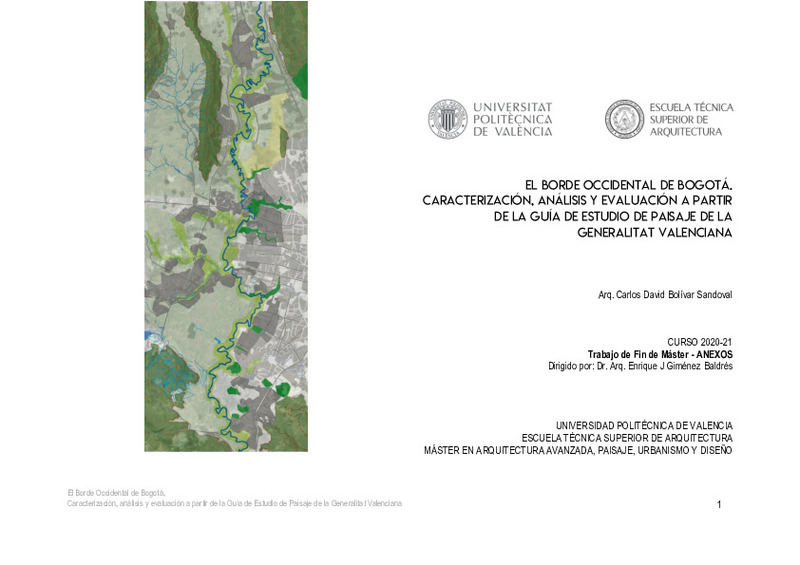
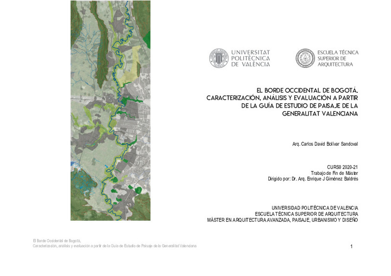
| dc.description.abstract | [ES] El proceso de formación del sistema urbano del borde occidental de Bogotá, en relación con los espacios naturales y las dinámicas de implantación de las infraestructuras y asentamientos formales e informales, ha conducido históricamente a una producción de paisaje que ha dado la espalda al río Bogotá y ha conducido a un deterioro de los espacios naturales y los elementos antrópicos que configuran el territorio del distrito capital de y los municipios vecinos (Soacha, Mosquera, Funza, Cota y Chía). Por esto realizo esta aproximación metodológica con componentes históricos y legales donde se busca la comprensión teórica del paisaje debido al alcance y su papel dentro del diseño, la gestión y el ordenamiento integral de este espacio articulador de desarrollo y bienestar para la ciudad. La pertinencia de mi trabajo se acentúa a partir de las intervenciones en la ciudad periférica y su inminente coexistencia con los recursos naturales, donde el territorio se ve claramente fragmentado y los discursos individuales de la legislación, urbanizadores legales e ilegales, determinaron y especularon sobre las directrices del desarrollo de este espacio y paralelamente se expusieron grandes problemáticas ambientales y urbanas. No existe una legislación o concepto que determine un camino claro sobre el ordenamiento del territorio a partir del paisaje, por lo que este trabajo se centra en realizar un diagnostico y caracterización de este espacio, con base en La Guía de Estudio de Paisaje de la Generalitat Valenciana, se complementa con la genealogía de la huella urbana desde 1920 a la fecha donde se detalla las diferentes características de los componentes del paisaje y su relación en el territorio y se ancla a la descripción del contexto jurídico con el que se ha determinado las pautas de crecimiento urbano, protección de espacios naturales y planes estructurantes. Debido a que el eje articulador del territorio es el Río Bogotá, integro a mi trabajo experiencias de ciudades río, donde el ordenamiento a partir de estos afluentes ha configurado espacios de desarrollo, recreación y protección. Finalmente concluyo mi trabajo con posibles escenarios y objetivos de intervención y rehabilitación para el área de estudio. | es_ES |
| dc.description.abstract | [EN] The process of formation of the urban system on the western edge of Bogotá, in relation to natural spaces and the dynamics of implantation of infrastructures and formal and informal settlements, has historically led to a production of landscape that has turned its back on the Bogotá river and it has led to a deterioration of the natural spaces and the anthropic elements that make up the territory of the capital district of and the neighboring municipalities (Soacha, Mosquera, Funza, Cota and Chía). That is why I carry out this methodological approach with historical and legal components where the theoretical understanding of the landscape is sought due to the scope and its role within the design, management and comprehensive ordering of this articulating space of development and well-being for the city. The relevance of my work is accentuated from the interventions in the peripheral city and its imminent coexistence with natural resources, where the territory is clearly fragmented and the individual discourses of the legislation, legal and illegal developers, determined and speculated on the guidelines for the development of this space and at the same time great environmental and urban problems were exposed. There is no legislation or concept that determines a clear path on the organization of the territory from the landscape, so this work focuses on making a diagnosis and characterization of this space, based on the Generalitat Landscape Study Guide Valencian, it is complemented by the genealogy of the urban footprint from 1920 to the date where the different characteristics of the components of the landscape and their relationship in the territory are detailed and is anchored to the description of the legal context with which the guidelines have been determined of urban growth, protection of natural spaces and structuring plans. As the articulating axis of the territory is the Bogotá River, I integrate experiences of river cities into my work, where the ordering from these tributaries has configured spaces for development, recreation and protection. Finally I conclude my work with possible scenarios and objectives of intervention and rehabilitation for the study area. | es_ES |
| dc.format.extent | 358 | es_ES |
| dc.language | Español | es_ES |
| dc.publisher | Universitat Politècnica de València | es_ES |
| dc.rights | Reserva de todos los derechos | es_ES |
| dc.subject | Rio Bogotá | es_ES |
| dc.subject | Borde occidental | es_ES |
| dc.subject | Paisaje | es_ES |
| dc.subject | Ordenamiento integral | es_ES |
| dc.subject | Estudio de paisaje | es_ES |
| dc.subject | Infraestructura verde | es_ES |
| dc.subject | Bogotá River | es_ES |
| dc.subject | Western edge | es_ES |
| dc.subject | Landscape | es_ES |
| dc.subject | Comprehensive planning | es_ES |
| dc.subject | Landscape study | es_ES |
| dc.subject | Green infrastructure | es_ES |
| dc.subject | Paisajismo | es_ES |
| dc.subject | Rehabilitaciones | es_ES |
| dc.subject | Rehabilitation | es_ES |
| dc.subject | Espacios naturales | es_ES |
| dc.subject | Nature spaces | es_ES |
| dc.subject.classification | URBANISTICA Y ORDENACION DEL TERRITORIO | es_ES |
| dc.subject.other | Máster Universitario en Arquitectura Avanzada, Paisaje, Urbanismo y Diseño-Màster Universitari en Arquitectura Avançada, Paisatge, Urbanisme i Disseny | es_ES |
| dc.title | El borde occidental de Bogotá. Caracterización, análisis y evaluación a partir de la Guía de Estudio de Paisaje de la Generalitat Valenciana. | es_ES |
| dc.type | Tesis de máster | es_ES |
| dc.rights.accessRights | Abierto | es_ES |
| dc.description.bibliographicCitation | Bolivar Sandoval, CD. (2020). El borde occidental de Bogotá. Caracterización, análisis y evaluación a partir de la Guía de Estudio de Paisaje de la Generalitat Valenciana. Universitat Politècnica de València. http://hdl.handle.net/10251/160360 | es_ES |
| dc.description.accrualMethod | TFGM | es_ES |
| dc.relation.pasarela | TFGM\135207 | es_ES |
Este ítem aparece en la(s) siguiente(s) colección(ones)
-
ETSA - Trabajos académicos [4687]
Escuela Técnica Superior de Arquitectura


