JavaScript is disabled for your browser. Some features of this site may not work without it.
Buscar en RiuNet
Listar
Mi cuenta
Estadísticas
Ayuda RiuNet
Admin. UPV
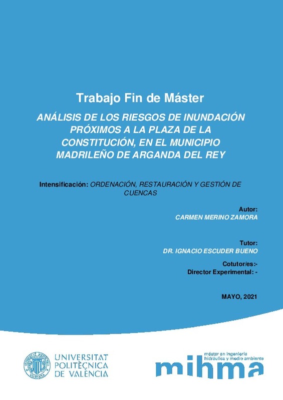
Análisis de los riesgos de inundación próximos a la plaza de la Constitución, en el municipio de Arganda del Rey
Mostrar el registro sencillo del ítem
Ficheros en el ítem
| dc.contributor.advisor | Escuder Bueno, Ignacio
|
es_ES |
| dc.contributor.author | Merino Zamora, Laura del Carmen
|
es_ES |
| dc.coverage.spatial | east=-3.4479063; north=40.3064463; name=Arganda del Rey, Madrid, Espanya | es_ES |
| dc.date.accessioned | 2021-07-01T07:29:02Z | |
| dc.date.available | 2021-07-01T07:29:02Z | |
| dc.date.created | 2021-05-25 | |
| dc.date.issued | 2021-07-01 | es_ES |
| dc.identifier.uri | http://hdl.handle.net/10251/168644 | |
| dc.description.abstract | [EN] This master's thesis aims to analyze the flood risks near the Plaza de la Constitución, in the Madrid municipality of Arganda del Rey, where it is known that after episodes of heavy rains the consequences are devastating. It should be noted that, on the one hand, the legislation in force both in the Community of Madrid and in the rest of Spain is advanced in the analysis of flood risk of fluvial origin; but on the other hand, there is a legislative gap regarding the risks of flooding of pluvial origin. The main objectives pursued are to understand the functioning of the hydrological and hydraulic system of the study basin, to know the deficiencies at the regulatory level existing in the municipality of Arganda del Rey with respect to the analysis and management of flood risks and, finally, to propose a series of actions to reduce flood risk. It is emphasized that flood analyses are not intended to provide a faithful representation of reality, but to lead to results from which duly justified conclusions can be drawn and which can help the manager when making decisions regarding flood risk management. The methodology followed is inspired by the methodology for the development of the National Floodplain Mapping System (Ministry of the Environment, Rural and Marine Affairs, 2011), the methodology used for the risk characterization of the ARPSIs in the Tajo Hydrographic Demarcation (Tajo Hydrographic Confederation, 2015), and the Complete and Quantitative methodology for flood risk analysis in urban areas (Escuder-Bueno et al., 2013). The computer tool used for the flood study is "Tygron" and the tool used for the risk analysis is "iPresas". From the study of the basin, it was found that the limiting factors for subsequent hydrological and hydraulic modeling are the climate, vegetation and land use, the physical characteristics of the soil (infiltration rate and porosity), the sewerage system and the relief. Also, the existing deficiencies in the Spanish legislation are identified and specifically in the municipality of Arganda del Rey, where there is currently neither a Municipal Action Plan against the risk of flooding nor an Emergency Plan against floods. After the simulation under five (5) different scenarios, the maximum flooded area is obtained for several affected areas (depth and velocity), as well as the water accumulation areas capable of storing a significant volume of water and delaying the peak of the flood. The main areas affected are the Plaza de la Constitución, Calle Real and its surroundings; the N-III road and MAXI DIA supermarket; and Avenida de Valencia. In addition, a sensitivity analysis contrasts the results obtained after the simulation in scenario 0 (T=10 years) with the information publicly available after the intense precipitation event of August 26, 2019 (10-year return period), in which the correct operation of the model is verified. Then, the results are analyzed from the point of view of social and economic risk, obtaining a social risk value of 31 potentially affected inhabitants per year and economic losses of 228,016 € per year. Finally, both structural and non-structural measures capable of reducing flood risk in the main areas affected by flooding as well as in other areas of the basin are theoretically proposed. | es_ES |
| dc.description.abstract | [ES] En el presente trabajo de fin de master se pretende realizar el análisis de los riesgos de inundación próximos a la plaza de la Constitución, en el municipio madrileño de Arganda del Rey, dónde se conoce que tras episodios de lluvias intensas las consecuencias son devastadoras. Destacar que la legislación vigente tanto en la Comunidad de Madrid como en el resto de España, está avanzada en el análisis de riesgo de inundación de origen fluvial; pero en cambio, que existe un vacío legislativo respecto a los riesgos de inundación de origen pluvial. Los objetivos principales que se persiguen consisten en entender el funcionamiento del sistema hidrológico e hidráulico de la cuenca de estudio, conocer las deficiencias a nivel normativo existentes en el municipio de Arganda del Rey respecto al análisis y gestión de los riesgos de inundación y, por último, proponer una serie de actuaciones de reducción del riesgo de inundación. Se hace hincapié en que los análisis de inundaciones no pretenden realizar una representación fiel de la realidad, sino conducir a unos resultados de los que se puedan extraer unas conclusiones debidamente justificadas y que puedan ayudar al gestor a la hora de la toma de decisiones en lo que respecta la gestión de los riesgos de inundación. La metodología seguida se inspira en la metodología para el desarrollo del Sistema Nacional de Cartografía de Zonas Inundables (Ministerio de Medio Ambiente, Medio Rural y Medio Marino, 2011), la metodología empleada para la caracterización del riesgo de las ARPSIs en la Demarcación Hidrográfica del Tajo (Confederación Hidrográfica del Tajo, 2015), y la metodología Completa y Cuantitativa de análisis de riesgo de inundación en zonas urbanas (Escuder-Bueno et al., 2013). La herramienta informática empleada para el estudio de inundaciones es “Tygron” y la herramienta empleada para el análisis del riesgo es “iPresas”. Del estudio de la cuenca se extrae que los factores limitantes para la posterior modelización hidrológica e hidráulica son el clima, la vegetación y uso del suelo, las características físicas del suelo (velocidad de infiltración y porosidad), el sistema de alcantarillado y el relieve. También, se identifican las deficiencias existentes en la legislación española y concretamente en el municipio de Arganda del Rey, donde actualmente no existe ni un Plan de Actuación Municipal frente al riesgo de inundación ni un Plan de Emergencia contra las inundaciones. Tras la simulación bajo cinco (5) escenarios distintos, se obtiene la máxima superficie inundada para varias zonas afectadas (calado y velocidad), así como las zonas de acumulación de agua capaces de almacenar un volumen importarte de agua y retrasar el pico de la avenida. Las principales áreas afectadas son la plaza de la Constitución, la calle Real y su entorno; la carretera N-III y supermercado MAXI DIA; y la avenida de Valencia. Además, mediante un análisis de sensibilidad se contrastan los resultados obtenidos tras la simulación en el escenario 0 (T=10 años) con la información disponible públicamente tras el evento de precipitación intensa ocurrida el 26 de agosto de 2019 (de periodo de retorno de 10 años), en el que se comprueba el correcto funcionamiento del modelo. Después, se analizan los resultados desde el punto de vista del riesgo social y económico, obteniendo un valor de riesgo social de 31 habitantes potencialmente afectados al año y unas pérdidas económicas de 228.016 € por año. Finalmente, se proponen de manera teórica medidas tanto estructurales como no estructurales capaces de reducir el riesgo de inundación en las principales áreas afectadas por la inundación así como en otras zonas de la cuenca. | es_ES |
| dc.format.extent | 38 | es_ES |
| dc.language | Español | es_ES |
| dc.publisher | Universitat Politècnica de València | es_ES |
| dc.rights | Reserva de todos los derechos | es_ES |
| dc.subject | Riesgo de inundación | es_ES |
| dc.subject | Lluvia | es_ES |
| dc.subject | Inundaciones | es_ES |
| dc.subject | Áreas urbanas | es_ES |
| dc.subject | Acciones y medidas | es_ES |
| dc.subject | Flood risk | es_ES |
| dc.subject | Rainfall | es_ES |
| dc.subject | Floods | es_ES |
| dc.subject | Urban areas | es_ES |
| dc.subject | Actions and measures | es_ES |
| dc.subject.classification | INGENIERIA HIDRAULICA | es_ES |
| dc.subject.other | Máster Universitario en Ingeniería Hidráulica y Medio Ambiente-Màster Universitari en Enginyeria Hidràulica i Medi Ambient | es_ES |
| dc.title | Análisis de los riesgos de inundación próximos a la plaza de la Constitución, en el municipio de Arganda del Rey | es_ES |
| dc.title.alternative | Analysis of flood risks near the Plaza de la Constitución, in the Madrid municipality of Arganda del Rey | es_ES |
| dc.type | Tesis de máster | es_ES |
| dc.rights.accessRights | Abierto | es_ES |
| dc.contributor.affiliation | Universitat Politècnica de València. Departamento de Ingeniería Hidráulica y Medio Ambiente - Departament d'Enginyeria Hidràulica i Medi Ambient | es_ES |
| dc.description.bibliographicCitation | Merino Zamora, LDC. (2021). Análisis de los riesgos de inundación próximos a la plaza de la Constitución, en el municipio de Arganda del Rey. Universitat Politècnica de València. http://hdl.handle.net/10251/168644 | es_ES |
| dc.description.accrualMethod | TFGM | es_ES |
| dc.relation.pasarela | TFGM\139710 | es_ES |


