


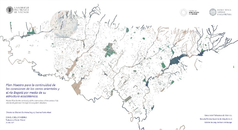
Plan Maestro para la continuidad de las conexiones de los cerros orientales y el río Bogotá por medio de su estructura ecosistémica
RiuNet: Repositorio Institucional de la Universidad Politécnica de Valencia
JavaScript is disabled for your browser. Some features of this site may not work without it.
Buscar en RiuNet
Listar
Mi cuenta
Estadísticas
Ayuda RiuNet
Admin. UPV

Plan Maestro para la continuidad de las conexiones de los cerros orientales y el río Bogotá por medio de su estructura ecosistémica
Mostrar el registro sencillo del ítem
Ficheros en el ítem
| dc.contributor.advisor | Quintana Seguí, Elisabet
|
es_ES |
| dc.contributor.advisor | Iñarra Abad, Susana
|
es_ES |
| dc.contributor.author | Cuéllar Medina, Daniel
|
es_ES |
| dc.coverage.spatial | east=-74.0561610220202; north=4.680963384667178; name=Cl. 94 #2151, Bogotá, Colòmbia | es_ES |
| dc.date.accessioned | 2021-12-17T11:07:46Z | |
| dc.date.available | 2021-12-17T11:07:46Z | |
| dc.date.created | 2021-09-22 | |
| dc.date.issued | 2021-12-17 | es_ES |
| dc.identifier.uri | http://hdl.handle.net/10251/178523 | |
| dc.description.abstract | [ES] Bogotá y su casco urbano esta delimitado por el oriente por los cerros y por el occidente por el río Bogotá, los cuales recorren la ciudad de norte a sur, estos límites físicos determinan la forma de crecimiento de la ciudad y su trazado, este siendo sectorizado por la existencia de diferentes ríos que nacen en los cerros orientales y que atraviesan diferentes puntos que recorren la capital de oriente (desde los cerros) a occidente (río Bogotá) donde se da su desembocadura se da en diferentes sistemas, Desembocaduras directas al río o a humedales. La propuesta recoge las cuencas del río Chico (cerros orientales) El canal El Virrey (pie de monte de los cerros), canal Río Negro, Río Salitre y humedal Juan Amarillo. Estos conforman el mismo sistema longitudinal y su estructura ecológica, que desemboca en el Río Bogotá, en los cuales se dan diferentes conflictos urbanos y paisajísticos. Relacionados permanentemente con el trazado de la ciudad y su infraestructura, estos toman un papel jerárquico en su relación con el entorno inmediato a lo largo de su trazado, en los cuales pasan por barrios residenciales, comerciales e industriales, los cuales cambian el perfil del río o de su canalización. Así pues, el objetivo es reconocer e implementar estrategias para planificar los diferentes bordes y perfiles de los ríos, poniendo en valor los sistemas de infraestructura de espacios abiertos y la estructura ecológica que caracteriza la ciudad, en el que, la infraestructura, el trazado urbano y su canalización degradan. Se propone un sistema ininterrumpido desde los cerros al río y las posibles conexiones que se puedan dar entre ellos a lo largo de su recorrido, reestructurando su trazado, ya que el actual es totalmente lineal, impermeable y en una desconexión con su entorno y ecología, lo cual ha traído problemáticas de desbordamiento, espacios residuales e interrupciones en su trazado Este plan concentraría los parques y áreas verdes cercanos al área de actuación, con la finalidad de complementar el sistema, favoreciendo la oferta de actividades relacionadas a los espacios existentes y desvaneciendo el limite actual en las infraestructuras, principalmente viales que seccionan los ríos. | es_ES |
| dc.description.abstract | [EN] Bogotá and its urban area is delimited on the east by the hills and on the west by the Bogotá river, which run through the city from north to south, these physical limits determine the growth of the city and its outline, this being sectorized by the existence of different rivers that are born in the eastern hills and that cross different points that run through the capital from the east (from the hills) to the west (Bogotá River) where its outlet occurs in different systems, direct outlets to the river or wetlands. The approach includes the watershed of the Chico river (eastern hills), El Virrey channel (foothills), Rio Negro channel, Rio Saltire and Juan Amarillo wetland. These make up the same longitudinal system and its ecological structure, which flows into the Bogotá River, in which are different urban and landscape conflicts. Permanently related to the layout of the city and its infrastructure, these take a hierarchical role in their relationship with the immediate surroundings along its outline, in which they pass through residential, commercial and industrial neighborhoods, which change the profile of the river, or its channeling. The objective is to recognize and implement strategies to plan the different edges and profiles of rivers, highlighting the infrastructure systems of open spaces and the ecological structure that characterizes the city, in which the infrastructure, the urban layout and its channeling degrade. An uninterrupted system is proposed from the hills to the river and the possible connections that may occur between them along its outline, restructuring it, since the current one is totally linear, impermeable and in a disconnection with its environment and ecology. which has brought problems of overflow, residual spaces and interruptions in its layout. This plan would concentrate the parks and green areas near the area of action, in order to complement the system, favoring the offer of activities related to the existing spaces and eliminating the current limit on infrastructures, mainly roads that section the rivers. | es_ES |
| dc.format.extent | 71 | es_ES |
| dc.language | Español | es_ES |
| dc.publisher | Universitat Politècnica de València | es_ES |
| dc.rights | Reserva de todos los derechos | es_ES |
| dc.subject | Servicios Ecosistémicos | es_ES |
| dc.subject | Estructura ecológica principal | es_ES |
| dc.subject | Trama Urbana | es_ES |
| dc.subject | Infraestructura principal | es_ES |
| dc.subject | Infraestructuras verde y azul | es_ES |
| dc.subject | Relación espacial | es_ES |
| dc.subject | Reserva forestal | es_ES |
| dc.subject | Parques urbanos | es_ES |
| dc.subject | Manejo hidráulico | es_ES |
| dc.subject | Relación cultural | es_ES |
| dc.subject | Corredor ecológico | es_ES |
| dc.subject | Ecosystem Services | es_ES |
| dc.subject | Main Ecological Structure | es_ES |
| dc.subject | Urban Plot | es_ES |
| dc.subject | Main Infrastructure | es_ES |
| dc.subject | Blue and Green Infrastructure | es_ES |
| dc.subject | Spatial Relationship | es_ES |
| dc.subject | Forest Reserve | es_ES |
| dc.subject | Urban Parks | es_ES |
| dc.subject | Hydraulic Management | es_ES |
| dc.subject | Cultural Relationship | es_ES |
| dc.subject | Ecological Corridor | es_ES |
| dc.subject.classification | EXPRESION GRAFICA ARQUITECTONICA | es_ES |
| dc.subject.classification | URBANISTICA Y ORDENACION DEL TERRITORIO | es_ES |
| dc.subject.other | Máster Universitario en Arquitectura del Paisaje-Master Universitari en Arquitectura del Paisatge | es_ES |
| dc.title | Plan Maestro para la continuidad de las conexiones de los cerros orientales y el río Bogotá por medio de su estructura ecosistémica | es_ES |
| dc.type | Tesis de máster | es_ES |
| dc.rights.accessRights | Abierto | es_ES |
| dc.description.bibliographicCitation | Cuéllar Medina, D. (2021). Plan Maestro para la continuidad de las conexiones de los cerros orientales y el río Bogotá por medio de su estructura ecosistémica. Universitat Politècnica de València. http://hdl.handle.net/10251/178523 | es_ES |
| dc.description.accrualMethod | TFGM | es_ES |
| dc.relation.pasarela | TFGM\142322 | es_ES |
Este ítem aparece en la(s) siguiente(s) colección(ones)
-
ETSA - Trabajos académicos [4493]
Escuela Técnica Superior de Arquitectura

Universitat Politècnica de València. Unidad de Documentación Científica de la Biblioteca (+34) 96 387 70 85 · RiuNet@bib.upv.es
El contenido de este sitio está bajo una licencia Creative Commons Reconocimiento – No Comercial – Sin Obra Derivada (by-nc-nd), salvo que se indique lo contrario.
Los metadatos de este sitio están bajo una licencia Dominio Público.
