JavaScript is disabled for your browser. Some features of this site may not work without it.
Buscar en RiuNet
Listar
Mi cuenta
Estadísticas
Ayuda RiuNet
Admin. UPV
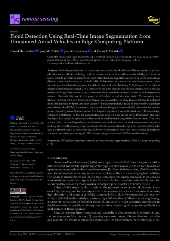
Flood Detection Using Real-Time Image Segmentation from Unmanned Aerial Vehicles on Edge-Computing Platform
Mostrar el registro sencillo del ítem
Ficheros en el ítem
| dc.contributor.author | Hernandez, Daniel
|
es_ES |
| dc.contributor.author | Cecilia-Canales, José María
|
es_ES |
| dc.contributor.author | Cano, Juan-Carlos
|
es_ES |
| dc.contributor.author | Tavares De Araujo Cesariny Calafate, Carlos Miguel
|
es_ES |
| dc.date.accessioned | 2023-05-12T18:02:00Z | |
| dc.date.available | 2023-05-12T18:02:00Z | |
| dc.date.issued | 2022-01 | es_ES |
| dc.identifier.issn | 2072-4292 | es_ES |
| dc.identifier.uri | http://hdl.handle.net/10251/193322 | |
| dc.description.abstract | [EN] With the proliferation of unmanned aerial vehicles (UAVs) in different contexts and application areas, efforts are being made to endow these devices with enough intelligence so as to allow them to perform complex tasks with full autonomy. In particular, covering scenarios such as disaster areas may become particularly difficult due to infrastructure shortage in some areas, often impeding a cloud-based analysis of the data in near-real time. Enabling AI techniques at the edge is therefore fundamental so that UAVs themselves can both capture and process information to gain an understanding of their context, and determine the appropriate course of action in an independent manner. Towards this goal, in this paper, we take determined steps towards UAV autonomy in a disaster scenario such as a flood. In particular, we use a dataset of UAV images relative to different floods taking place in Spain, and then use an AI-based approach that relies on three widely used deep neural networks (DNNs) for semantic segmentation of images, to automatically determine the regions more affected by rains (flooded areas). The targeted algorithms are optimized for GPU-based edge computing platforms, so that the classification can be carried out on the UAVs themselves, and only the algorithm output is uploaded to the cloud for real-time tracking of the flooded areas. This way, we are able to reduce dependency on infrastructure, and to reduce network resource consumption, making the overall process greener and more robust to connection disruptions. Experimental results using different types of hardware and different architectures show that it is feasible to perform advanced real-time processing of UAV images using sophisticated DNN-based solutions. | es_ES |
| dc.description.sponsorship | This work is derived from R&D projects RTI2018-096384-B-I00 and RTC2019-007159-5, as well as the Ramon y Cajal Grant RYC2018-025580-I, funded by MCIN/AEI/10.13039/501100011033, "FSE invest in your future" and "ERDF A way of making Europe", and by the "Conselleria de Educacion, Investigacion, Cultura y Deporte, Direccio General de Ciencia i Investigacio, Proyectos AICO/2020", Spain, under Grant AICO/2020/302. | es_ES |
| dc.language | Inglés | es_ES |
| dc.publisher | MDPI AG | es_ES |
| dc.relation.ispartof | Remote Sensing | es_ES |
| dc.rights | Reconocimiento (by) | es_ES |
| dc.subject | UAVs | es_ES |
| dc.subject | Flood detection | es_ES |
| dc.subject | Natural disasters | es_ES |
| dc.subject | Semantic segmentation | es_ES |
| dc.subject | DNN | es_ES |
| dc.subject | AI | es_ES |
| dc.subject | Edge computing | es_ES |
| dc.subject | GPU | es_ES |
| dc.subject.classification | ARQUITECTURA Y TECNOLOGIA DE COMPUTADORES | es_ES |
| dc.title | Flood Detection Using Real-Time Image Segmentation from Unmanned Aerial Vehicles on Edge-Computing Platform | es_ES |
| dc.type | Artículo | es_ES |
| dc.identifier.doi | 10.3390/rs14010223 | es_ES |
| dc.relation.projectID | info:eu-repo/grantAgreement/AEI/Plan Estatal de Investigación Científica y Técnica y de Innovación 2017-2020/RTI2018-096384-B-I00/ES/SOLUCIONES PARA UNA GESTION EFICIENTE DEL TRAFICO VEHICULAR BASADAS EN SISTEMAS Y SERVICIOS EN RED/ | es_ES |
| dc.relation.projectID | info:eu-repo/grantAgreement/AGENCIA ESTATAL DE INVESTIGACION//RTC2019-007159-5//DESARROLLO DE INFRAESTRUCTURAS IOT DE ALTAS PRESTACIONES CONTRA EL CAMBIO CLIMÁTICO BASADAS EN INTELIGENCIA ARTIFICIAL/ | es_ES |
| dc.relation.projectID | info:eu-repo/grantAgreement/MICINN//RYC-2018-025580-I//AYUDA ADICIONAL RAMON Y CAJAL/ | es_ES |
| dc.relation.projectID | info:eu-repo/grantAgreement/Conselleria d'Educació, Investigació, Cultura i Esport de la Generalitat Valenciana//AICO%2F2020%2F302/ | es_ES |
| dc.rights.accessRights | Abierto | es_ES |
| dc.contributor.affiliation | Universitat Politècnica de València. Escola Tècnica Superior d'Enginyeria Informàtica | es_ES |
| dc.contributor.affiliation | Universitat Politècnica de València. Departamento de Informática de Sistemas y Computadores - Departament d'Informàtica de Sistemes i Computadors | es_ES |
| dc.description.bibliographicCitation | Hernandez, D.; Cecilia-Canales, JM.; Cano, J.; Tavares De Araujo Cesariny Calafate, CM. (2022). Flood Detection Using Real-Time Image Segmentation from Unmanned Aerial Vehicles on Edge-Computing Platform. Remote Sensing. 14(1):1-20. https://doi.org/10.3390/rs14010223 | es_ES |
| dc.description.accrualMethod | S | es_ES |
| dc.relation.publisherversion | https://doi.org/10.3390/rs14010223 | es_ES |
| dc.description.upvformatpinicio | 1 | es_ES |
| dc.description.upvformatpfin | 20 | es_ES |
| dc.type.version | info:eu-repo/semantics/publishedVersion | es_ES |
| dc.description.volume | 14 | es_ES |
| dc.description.issue | 1 | es_ES |
| dc.relation.pasarela | S\452799 | es_ES |
| dc.contributor.funder | European Social Fund | es_ES |
| dc.contributor.funder | AGENCIA ESTATAL DE INVESTIGACION | es_ES |
| dc.contributor.funder | Agencia Estatal de Investigación | es_ES |
| dc.contributor.funder | European Regional Development Fund | es_ES |
| dc.contributor.funder | Ministerio de Ciencia e Innovación | es_ES |
| dc.contributor.funder | Conselleria d'Educació, Investigació, Cultura i Esport de la Generalitat Valenciana | es_ES |


