


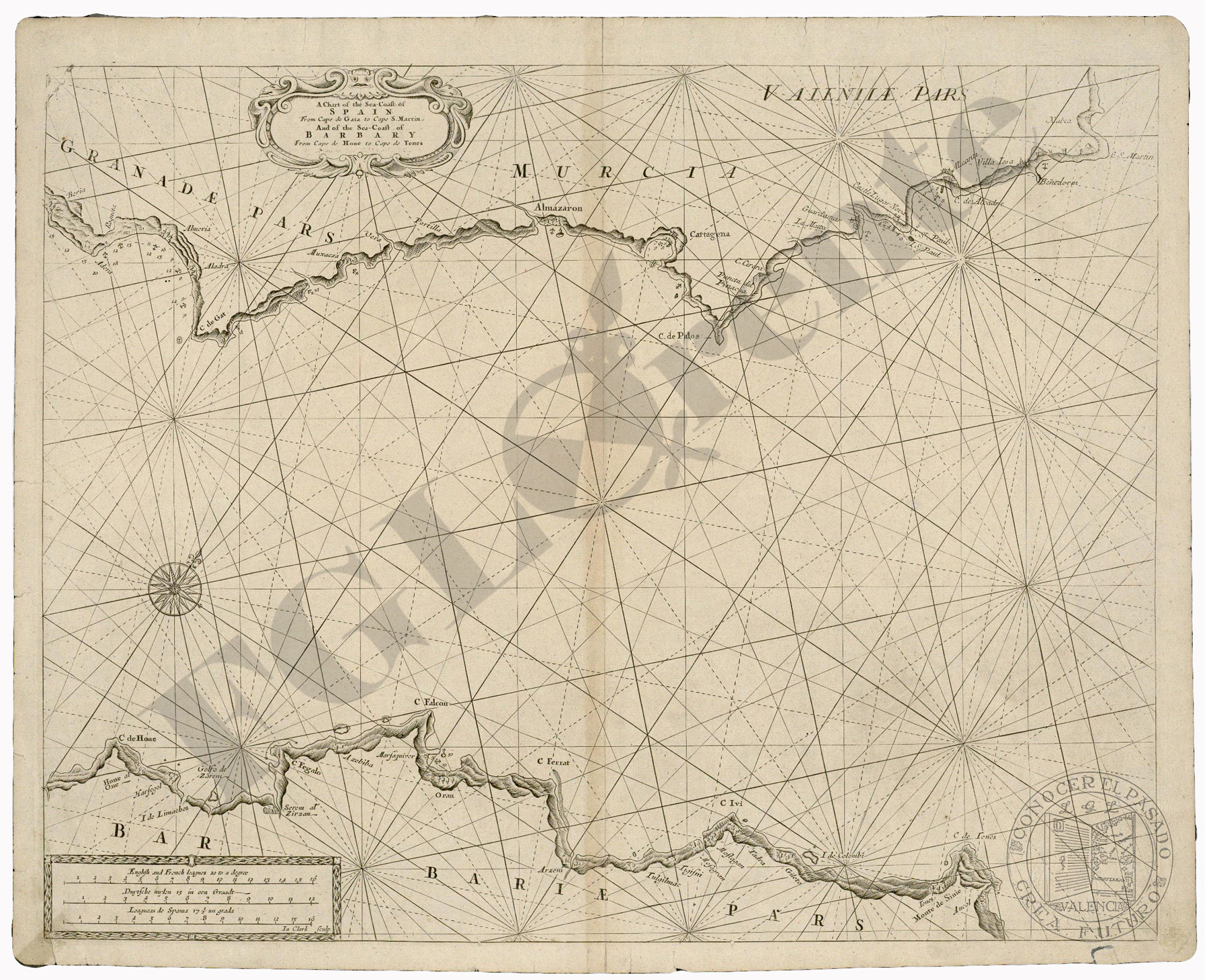
A Chart of the Sea Coast of Spain
RiuNet: Repositorio Institucional de la Universidad Politécnica de Valencia
JavaScript is disabled for your browser. Some features of this site may not work without it.
Buscar en RiuNet
Listar
Mi cuenta
Estadísticas
Ayuda RiuNet
Admin. UPV

A Chart of the Sea Coast of Spain
Mostrar el registro completo del ítem
Seller, J. (1670). A Chart of the Sea Coast of Spain. Londres: Nout and Page. http://hdl.handle.net/10251/4957.
Por favor, use este identificador para citar o enlazar este ítem: http://hdl.handle.net/10251/4957
Ficheros en el ítem
Metadatos del ítem
| Título: | A Chart of the Sea Coast of Spain | |
| Autor: | Seller, John | |
| Ilustrador: |
|
|
| Fecha difusión: |
|
|
| Resumen: |
|
|
| Palabras clave: |
|
|
| Derechos de uso: | Reserva de todos los derechos | |
| Fuente: |
|
|
| Editorial: |
|
|
| Descripción: |
|
|
| Tipo: |
|
Localización
recommendations
Este ítem aparece en la(s) siguiente(s) colección(ones)

Universitat Politècnica de València. Unidad de Documentación Científica de la Biblioteca (+34) 96 387 70 85 · RiuNet@bib.upv.es
El contenido de este sitio está bajo una licencia Creative Commons Reconocimiento – No Comercial – Sin Obra Derivada (by-nc-nd), salvo que se indique lo contrario.
Los metadatos de este sitio están bajo una licencia Dominio Público.
