JavaScript is disabled for your browser. Some features of this site may not work without it.
Buscar en RiuNet
Listar
Mi cuenta
Estadísticas
Ayuda RiuNet
Admin. UPV
Soil moisture estimation using multi linear regression with terraSAR-X data
Mostrar el registro sencillo del ítem
Ficheros en el ítem
| dc.contributor.author | García, G.
|
es_ES |
| dc.contributor.author | Brogioni, M.
|
es_ES |
| dc.contributor.author | Venturini, V.
|
es_ES |
| dc.contributor.author | Rodriguez, L.
|
es_ES |
| dc.contributor.author | Fontanelli, G.
|
es_ES |
| dc.contributor.author | Walker, E.
|
es_ES |
| dc.contributor.author | Graciani, S.
|
es_ES |
| dc.contributor.author | Macelloni, G.
|
es_ES |
| dc.coverage.spatial | east=-61.432392300000004; north=-30.9977485; name=Ataliva, Santa Fe, Argentina | |
| dc.date.accessioned | 2017-05-03T07:40:44Z | |
| dc.date.available | 2017-05-03T07:40:44Z | |
| dc.date.issued | 2016-06-27 | |
| dc.identifier.issn | 1133-0953 | |
| dc.identifier.uri | http://hdl.handle.net/10251/80369 | |
| dc.description | Revista oficial de la Asociación Española de Teledetección | |
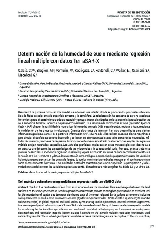
| dc.description.abstract | [EN] The first five centimeters of soil form an interface where the main heat fluxes exchanges between the land surface and the atmosphere occur. Besides ground measurements, remote sensing has proven to be an excellent tool for the monitoring of spatial and temporal distributed data of the most relevant Earth surface parameters including soil’s parameters. Indeed, active microwave sensors (Synthetic Aperture Radar - SAR) offer the opportunity to monitor soil moisture (HS) at global, regional and local scales by monitoring involved processes. Several inversion algorithms, that derive geophysical information as HS from SAR data, were developed. Many of them use electromagnetic models for simulating the backscattering coefficient and are based on statistical techniques, such as neural networks, inversion methods and regression models. Recent studies have shown that simple multiple regression techniques yield satisfactory results. The involved geophysical variables in these methodologies are descriptive of the soil structure, microwave characteristics and land use. Therefore, in this paper we aim at developing a multiple linear regression model to estimate HS on flat agricultural regions using TerraSAR-X satellite data and data from a ground weather station. The results show that the backscatter, the precipitation and the relative humidity are the explanatory variables of HS. The results obtained presented a RMSE of 5.4 and a R2 of about 0.6 | es_ES |
| dc.description.abstract | [ES] Los primeros cinco centímetros del suelo forman una interfaz donde se producen los principales intercam-bios de flujos de calor entre la superficie terrestre y la atmósfera. La teledetección ha demostrado ser una excelente herramienta para el seguimiento de datos espacial y temporalmente distribuidos de las características sobresalientes de la superficie terrestre, incluidos los parámetros del suelo. Los sensores de microondas activos (Synthetic Aperture Radar- SAR) ofrecen la posibilidad de monitorizar la humedad de suelo (HS) a escala global, regional y local, mediante la modelación de los procesos involucrados. Diversos algoritmos de inversión han sido desarrollados para derivar información geofísica, como HS, a partir de información SAR. Muchos de ellos utilizan modelos electromagnéticos para simular el coeficiente de retrodispersión y se basan en técnicas estadísticas tales como redes neuronales, mé-todos de inversión y modelos de regresión. Estudios recientes han demostrado que las técnicas simples de regresión múltiple arrojan resultados aceptables. Las variables geofísicas implicadas en estas metodologías son descriptivas de la estructura del suelo, las características de las microondas y la cobertura del suelo. Por esto, en este trabajo se propone desarrollar un modelo de regresión lineal múltiple para estimar HS en zonas de llanura combinando datos de la misión satelital TerraSAR-X y datos de una estación meteorológica. La modelación propuesta involucra las variables hidrológicas que caracterizan las zonas de llanura, donde los movimientos verticales de agua en el suelo predominan sobre el escurrimiento horizontal. Los resultados obtenidos muestran que la retrodispersión, la precipitación y la hu-medad relativa del aire son las variables explicativas de HS. El modelo obtenido arrojó un RMSE de 5,4 y un R2 de 0,6. | es_ES |
| dc.language | Español | es_ES |
| dc.publisher | Universitat Politècnica de València | |
| dc.relation.ispartof | Revista de Teledetección | |
| dc.rights | Reconocimiento - No comercial - Sin obra derivada (by-nc-nd) | es_ES |
| dc.subject | Humedad de suelo | es_ES |
| dc.subject | Regresión múltiple | es_ES |
| dc.subject | TerraSAR-X | es_ES |
| dc.subject | Soil moisture | es_ES |
| dc.subject | Multiple regression | es_ES |
| dc.title | Soil moisture estimation using multi linear regression with terraSAR-X data | es_ES |
| dc.title.alternative | Determinación de la humedad de suelo mediante regresión lineal múltiple con datos TerraSAR-X | es_ES |
| dc.type | Artículo | es_ES |
| dc.date.updated | 2017-05-03T07:01:12Z | |
| dc.identifier.doi | 10.4995/raet.2016.4024 | |
| dc.rights.accessRights | Abierto | es_ES |
| dc.description.bibliographicCitation | García, G.; Brogioni, M.; Venturini, V.; Rodriguez, L.; Fontanelli, G.; Walker, E.; Graciani, S.... (2016). Soil moisture estimation using multi linear regression with terraSAR-X data. Revista de Teledetección. (46):73-81. https://doi.org/10.4995/raet.2016.4024 | es_ES |
| dc.description.accrualMethod | SWORD | es_ES |
| dc.relation.publisherversion | https://doi.org/10.4995/raet.2016.4024 | es_ES |
| dc.description.upvformatpinicio | 73 | es_ES |
| dc.description.upvformatpfin | 81 | es_ES |
| dc.type.version | info:eu-repo/semantics/publishedVersion | es_ES |
| dc.description.issue | 46 | |
| dc.identifier.eissn | 1988-8740 |


