


Graphic resources for the GIS positioning and analysis of 20th-century fortification: bunkers in the vicinity of the rock of Gibraltar
RiuNet: Repositorio Institucional de la Universidad Politécnica de Valencia
JavaScript is disabled for your browser. Some features of this site may not work without it.
Buscar en RiuNet
Listar
Mi cuenta
Estadísticas
Ayuda RiuNet
Admin. UPV


Graphic resources for the GIS positioning and analysis of 20th-century fortification: bunkers in the vicinity of the rock of Gibraltar
Mostrar el registro sencillo del ítem
Ficheros en el ítem
| dc.contributor.author | Atanasio Guisado, Alberto
|
es_ES |
| dc.contributor.author | Arévalo Rodríguez, Federico
|
es_ES |
| dc.contributor.author | Molina Rozalem, Juan Francisco
|
es_ES |
| dc.coverage.spatial | east=-5.341724099999999; north=36.1440934; name=Peñón de Gibraltar, Gibraltar GX11 1AA, Gibraltar | es_ES |
| dc.date.accessioned | 2021-01-19T12:06:51Z | |
| dc.date.available | 2021-01-19T12:06:51Z | |
| dc.date.issued | 2020-11-17 | |
| dc.identifier.issn | 1133-6137 | |
| dc.identifier.uri | http://hdl.handle.net/10251/159408 | |
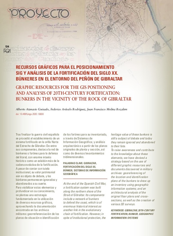
| dc.description.abstract | [EN] At the end of the Spanish Civil War, a fortification system was built along the northern shore of the Strait of Gibraltar. Its components include a network of bunkers to defend the coast, which is of enormous historical interest as another link in the evolutionary chain of fortification. However, in spite of institutional protection, the heritage value of these bunkers is still a subject of debate and today they remain ignored and abandoned to their fate. To raise awareness and contribute to the knowledge about these elements, we have devised a strategy based on the use of different graphic resources and documents discovered in military archives: georeferencing of the location and identification plans of the bunkers to draw up an inventory using geographic information systems; and an architectural analysis of the original floor plans and crosssections, as well as the creation of various 3D surveys. | es_ES |
| dc.description.abstract | [ES] Tras finalizar la guerra civil española se procedió al establecimiento de un sistema fortificado en la orilla Norte del Estrecho de Gibraltar. De entre sus componentes, destaca la red de búnkeres o fortines para la defensa del litoral, con enorme interés histórico como un eslabón más de la cadena evolutiva de la fortificación. A pesar de contar con tutela institucional, su valor patrimonial aún es objeto de debate, y los búnkeres permanecen ignorados y abandonados a su suerte.Para visibilizar estos elementos y profundizar en su conocimiento, se plantea una estrategia fundamentada en la utilización de diversos recursos gráficos, aprovechando la documentación encontrada en los archivos militares: georreferenciación de los planos de situación e identificación de los fortines para su inventariado, a través de Sistemas de Información Geográfica; y análisis arquitectónico a partir de los planos originales de planta y sección, así como de diversos levantamientos tridimensionales. | es_ES |
| dc.description.sponsorship | Proyecto I+D+i HAR2016-78113-R del Programa Nacional de Investigación, Desarrollo e Innovación. Ministerio de Economía y Competitividad y fondos FEDER | es_ES |
| dc.language | Español | es_ES |
| dc.language | Inglés | es_ES |
| dc.publisher | Universitat Politècnica de València | es_ES |
| dc.relation.ispartof | EGA Expresión Gráfica Arquitectónica | es_ES |
| dc.rights | Reconocimiento - No comercial - Sin obra derivada (by-nc-nd) | es_ES |
| dc.subject | Gibraltar | es_ES |
| dc.subject | 20th-century fortification | es_ES |
| dc.subject | Bunker | es_ES |
| dc.subject | Geographic information systems | es_ES |
| dc.subject | Fortificación del siglo XX | es_ES |
| dc.subject | Búnker | es_ES |
| dc.subject | Sistemas de Información Geográfica | es_ES |
| dc.title | Graphic resources for the GIS positioning and analysis of 20th-century fortification: bunkers in the vicinity of the rock of Gibraltar | es_ES |
| dc.title.alternative | Recursos gráficos para el posicionamiento SIG y análisis de la fortificación del siglo XX. Búnkeres en el entorno del peñón de Gibraltar | es_ES |
| dc.type | Artículo | es_ES |
| dc.identifier.doi | 10.4995/ega.2020.13698 | |
| dc.relation.projectID | info:eu-repo/grantAgreement/MINECO//HAR2016-78113-R/ES/TUTELA SOSTENIBLE DEL PATRIMONIO CULTURAL A TRAVES DE MODELOS DIGITALES BIM Y SIG. CONTRIBUCION AL CONOCIMIENTO E INNOVACION SOCIAL/ | es_ES |
| dc.rights.accessRights | Abierto | es_ES |
| dc.description.bibliographicCitation | Atanasio Guisado, A.; Arévalo Rodríguez, F.; Molina Rozalem, JF. (2020). Graphic resources for the GIS positioning and analysis of 20th-century fortification: bunkers in the vicinity of the rock of Gibraltar. EGA Expresión Gráfica Arquitectónica. 25(40):134-145. https://doi.org/10.4995/ega.2020.13698 | es_ES |
| dc.description.accrualMethod | OJS | es_ES |
| dc.relation.publisherversion | https://doi.org/10.4995/ega.2020.13698 | es_ES |
| dc.description.upvformatpinicio | 134 | es_ES |
| dc.description.upvformatpfin | 145 | es_ES |
| dc.type.version | info:eu-repo/semantics/publishedVersion | es_ES |
| dc.description.volume | 25 | es_ES |
| dc.description.issue | 40 | es_ES |
| dc.identifier.eissn | 2254-6103 | |
| dc.relation.pasarela | OJS\13698 | es_ES |
| dc.contributor.funder | Ministerio de Economía y Competitividad | es_ES |
| dc.description.references | - ARÉVALO RODRÍGUEZ, F. y ATANASIO GUISADO, A. 2013. 'La fortificación del Campo de Gibraltar tras la guerra civil española', Revista de Historia Militar, 114. Madrid: Instituto de Historia y Cultura Militar, pp. 109-156. | es_ES |
| dc.description.references | - ATANASIO GUISADO, A. y ARÉVALO RODRÍGUEZ, F. 2018. 'Fortificación del siglo XX: sistema, arquitectura y patrimonio. El dispositivo de la orilla norte del estrecho de Gibraltar'. Revista i2. Investigación e Innovación en Arquitectura y Territorio. Vol. 6.1. Alicante: Dpto. de Expresión Gráfica, Composición y Proyectos. Universidad de Alicante. https://doi.org/10.14198/i2.2018.6.1.01 | es_ES |
| dc.description.references | - ATANASIO GUISADO, A. y MARTÍNEZ MEDINA, A. 2018. 'Fortificación del siglo XX en la orilla norte del estrecho de Gibraltar'", en MAROTTA, A., SPALLONE, R. (ed.). Defensive architecture of the Mediterranean, vol. 9. Proceedings of the International Conference on Modern Age Fortification of the Mediterranean Coast FORTMED 2018. Turin: Politecnico di Torino, pp. 1357-1364. | es_ES |
| dc.description.references | - BONET CORREA, A. 1976. 'El búnker, monumento funerario al delirio nazi', Triunfo, 685, pp. 36-38. | es_ES |
| dc.description.references | - GRIFFITH, P. 2004. Fortifications of the Western Front 1914-1918, Fortress 24. Oxford: Osprey Publishing. | es_ES |
| dc.description.references | - MARTÍNEZ MEDINA, A. y PIRINU, A. 2019. 'Tra la terra e il cielo. Architettura di guerra in Sardegna: un paesaggio da conservare", ArcHistoR, 11, pp. 88-125. | es_ES |
| dc.description.references | - SCHOFIELD, J. 2009. Aftermath: Readings in the Archaeology of Recent Conflict. Swindon: Springer. | es_ES |
| dc.description.references | - VIRILIO, P. 1994. Bunker Archaeology. New York: Princeton Architectural Press. | es_ES |
Este ítem aparece en la(s) siguiente(s) colección(ones)

Universitat Politècnica de València. Unidad de Documentación Científica de la Biblioteca (+34) 96 387 70 85 · RiuNet@bib.upv.es
El contenido de este sitio está bajo una licencia Creative Commons Reconocimiento – No Comercial – Sin Obra Derivada (by-nc-nd), salvo que se indique lo contrario.
Los metadatos de este sitio están bajo una licencia Dominio Público.
