


LA CARTOGRAFÍA ESPAÑOLA DE LAS COSTAS DE NORTEAMÉRICA DE LOS SIGLOS XVI AL XVIII: APORTACIONES AL CONTEXTO CIENTÍFICO INTERNACIONAL
RiuNet: Repositorio Institucional de la Universidad Politécnica de Valencia
JavaScript is disabled for your browser. Some features of this site may not work without it.
Buscar en RiuNet
Listar
Mi cuenta
Estadísticas
Ayuda RiuNet
Admin. UPV


LA CARTOGRAFÍA ESPAÑOLA DE LAS COSTAS DE NORTEAMÉRICA DE LOS SIGLOS XVI AL XVIII: APORTACIONES AL CONTEXTO CIENTÍFICO INTERNACIONAL
Mostrar el registro sencillo del ítem
Ficheros en el ítem
| dc.contributor.author | Chias Navarro, Pilar
|
es_ES |
| dc.date.accessioned | 2013-01-25T08:01:00Z | |
| dc.date.available | 2013-01-25T08:01:00Z | |
| dc.date.issued | 2011 | |
| dc.identifier.issn | 1133-6137 | |
| dc.identifier.uri | http://hdl.handle.net/10251/19022 | |
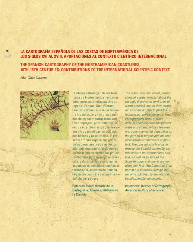
| dc.description.abstract | [EN] The main European naval powers showed a great interest about the recently discovered territories of North America, due to their strategic position in order to plan the future wars and settlements. Their cartographers drew a great amount of manuscript and printed maps and charts, whose features and accuracy varied depending on the particular targets and the technical advances that were applied to it. The present article aims to expose the Spanish scientific contributions to the international context, as well as to spread the Spanish maps and charts drawn along the 16th-18th Centuries. This part of our Cultural Heritage still remains unknown to the international scientific community. | es_ES |
| dc.description.abstract | [ES] El interés estratégico de los territorios de Norteamérica llevó a las principales potencias navales europeas ¿España, Gran Bretaña, Francia y Holanda¿ a redactar entre los siglos XVI y XVIII gran cantidad de mapas y cartas manuscritos e impresos, para poder disponer de una información precisa sobre ellos y planificar las actuaciones bélicas y colonización. El presente artículo expone sus principales características y aspectos diferenciales, con el fin de comparar las técnicas empleadas por los cartógrafos para mejorar su precisión, y destacar las aportaciones españolas al contexto científico internacional, así como de difundir la aún desconocida cartografía española de la época. | es_ES |
| dc.language | Español | es_ES |
| dc.language | Inglés | |
| dc.publisher | Editorial Universitat Politècnica de València | es_ES |
| dc.relation.ispartof | EGA. Revista de Expresión Gráfica Arquitectónica | |
| dc.rights | Reserva de todos los derechos | es_ES |
| dc.subject | Historia de la cartografía | es_ES |
| dc.subject | Historia de la ciencia | es_ES |
| dc.subject | América | es_ES |
| dc.subject | History of cartography | es_ES |
| dc.subject | History of science | es_ES |
| dc.title | LA CARTOGRAFÍA ESPAÑOLA DE LAS COSTAS DE NORTEAMÉRICA DE LOS SIGLOS XVI AL XVIII: APORTACIONES AL CONTEXTO CIENTÍFICO INTERNACIONAL | es_ES |
| dc.title.alternative | THE SPANISH CARTOGRAPHY OF THE NORTHAMERICAN COASTLINES, 16TH-18TH CENTURIES: CONTRIBUTIONS TO THE INTERNATIONAL SCIENTIFIC CONTEXT | es_ES |
| dc.type | Artículo | es_ES |
| dc.date.updated | 2013-01-24T09:02:15Z | |
| dc.identifier.doi | 10.4995/ega.2011.1334 | |
| dc.rights.accessRights | Abierto | es_ES |
| dc.description.bibliographicCitation | Chias Navarro, P. (2011). LA CARTOGRAFÍA ESPAÑOLA DE LAS COSTAS DE NORTEAMÉRICA DE LOS SIGLOS XVI AL XVIII: APORTACIONES AL CONTEXTO CIENTÍFICO INTERNACIONAL. EGA. Revista de Expresión Gráfica Arquitectónica. 16(18):38-49. https://doi.org/10.4995/ega.2011.1334 | es_ES |
| dc.description.accrualMethod | SWORD | es_ES |
| dc.relation.publisherversion | https://doi.org/10.4995/ega.2011.1334 | es_ES |
| dc.description.upvformatpinicio | 38 | |
| dc.description.upvformatpfin | 49 | |
| dc.description.volume | 16 | |
| dc.description.issue | 18 | |
| dc.identifier.eissn | 2254-6103 |
Este ítem aparece en la(s) siguiente(s) colección(ones)

Universitat Politècnica de València. Unidad de Documentación Científica de la Biblioteca (+34) 96 387 70 85 · RiuNet@bib.upv.es
El contenido de este sitio está bajo una licencia Creative Commons Reconocimiento – No Comercial – Sin Obra Derivada (by-nc-nd), salvo que se indique lo contrario.
Los metadatos de este sitio están bajo una licencia Dominio Público.
