JavaScript is disabled for your browser. Some features of this site may not work without it.
Buscar en RiuNet
Listar
Mi cuenta
Estadísticas
Ayuda RiuNet
Admin. UPV
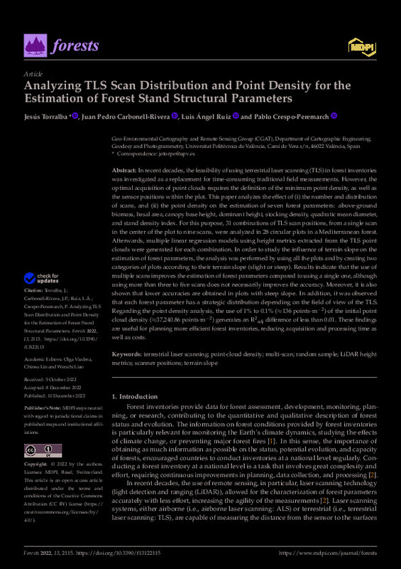
Analyzing TLS Scan Distribution and Point Density for the Estimation of Forest Stand Structural Parameters
Mostrar el registro sencillo del ítem
Ficheros en el ítem
| dc.contributor.author | Torralba, Jesús
|
es_ES |
| dc.contributor.author | Carbonell-Rivera, Juan Pedro
|
es_ES |
| dc.contributor.author | Ruiz Fernández, Luis Ángel
|
es_ES |
| dc.contributor.author | Crespo-Peremarch, Pablo
|
es_ES |
| dc.date.accessioned | 2023-05-24T18:02:03Z | |
| dc.date.available | 2023-05-24T18:02:03Z | |
| dc.date.issued | 2022-12 | es_ES |
| dc.identifier.uri | http://hdl.handle.net/10251/193573 | |
| dc.description.abstract | [EN] In recent decades, the feasibility of using terrestrial laser scanning (TLS) in forest inventories was investigated as a replacement for time-consuming traditional field measurements. However, the optimal acquisition of point clouds requires the definition of the minimum point density, as well as the sensor positions within the plot. This paper analyzes the effect of (i) the number and distribution of scans, and (ii) the point density on the estimation of seven forest parameters: above-ground biomass, basal area, canopy base height, dominant height, stocking density, quadratic mean diameter, and stand density index. For this purpose, 31 combinations of TLS scan positions, from a single scan in the center of the plot to nine scans, were analyzed in 28 circular plots in a Mediterranean forest. Afterwards, multiple linear regression models using height metrics extracted from the TLS point clouds were generated for each combination. In order to study the influence of terrain slope on the estimation of forest parameters, the analysis was performed by using all the plots and by creating two categories of plots according to their terrain slope (slight or steep). Results indicate that the use of multiple scans improves the estimation of forest parameters compared to using a single one, although using more than three to five scans does not necessarily improves the accuracy. Moreover, it is also shown that lower accuracies are obtained in plots with steep slope. In addition, it was observed that each forest parameter has a strategic distribution depending on the field of view of the TLS. Regarding the point density analysis, the use of 1% to 0.1% (¿136 points·m¿2) of the initial point cloud density (¿37,240.86 points·m¿2) generates an R2adj difference of less than 0.01. These findings are useful for planning more efficient forest inventories, reducing acquisition and processing time as well as costs. | es_ES |
| dc.description.sponsorship | This research has been funded by the project PID2020-117808RB-C21 MCIN/AEI/10.13039/501100011033 and by the grant PEJ2018-002924-A Fondo de Garantia Juvenil en I+D+i ESF Investing in your future. | es_ES |
| dc.language | Inglés | es_ES |
| dc.publisher | MDPI AG | es_ES |
| dc.relation.ispartof | Forests | es_ES |
| dc.rights | Reconocimiento (by) | es_ES |
| dc.subject | Terrestrial laser scanning | es_ES |
| dc.subject | Point-cloud density | es_ES |
| dc.subject | Multi-scan | es_ES |
| dc.subject | Random sample | es_ES |
| dc.subject | LiDAR height metrics | es_ES |
| dc.subject | Scanner positions | es_ES |
| dc.subject | Terrain slope | es_ES |
| dc.subject.classification | INGENIERIA CARTOGRAFICA, GEODESIA Y FOTOGRAMETRIA | es_ES |
| dc.title | Analyzing TLS Scan Distribution and Point Density for the Estimation of Forest Stand Structural Parameters | es_ES |
| dc.type | Artículo | es_ES |
| dc.identifier.doi | 10.3390/f13122115 | es_ES |
| dc.relation.projectID | info:eu-repo/grantAgreement/AEI/Plan Estatal de Investigación Científica y Técnica y de Innovación 2017-2020/PID2020-117808RB-C21/ES/CARTOGRAFIADO ESPECTRAL Y ESTRUCTURAL 3D DE COMBUSTIBLE MEDITERRANEO PARA LA MODELIZACION DEL COMPORTAMIENTO DEL FUEGO/ | es_ES |
| dc.relation.projectID | info:eu-repo/grantAgreement/AEI//PEJ2018-002924-A-AR//AYUDA GARANTIA JUVENIL AEI. ACTUACION: FORMACION EN PROCESADO DE DATOS CARTOGRAFICOS PARA LA PREVENCION Y RESPUESTA A INCENDIOS FORESTALES/ | es_ES |
| dc.rights.accessRights | Abierto | es_ES |
| dc.contributor.affiliation | Universitat Politècnica de València. Escuela Técnica Superior de Ingeniería Geodésica, Cartográfica y Topográfica - Escola Tècnica Superior d'Enginyeria Geodèsica, Cartogràfica i Topogràfica | es_ES |
| dc.contributor.affiliation | Universitat Politècnica de València. Departamento de Ingeniería Cartográfica Geodesia y Fotogrametría - Departament d'Enginyeria Cartogràfica, Geodèsia i Fotogrametria | es_ES |
| dc.description.bibliographicCitation | Torralba, J.; Carbonell-Rivera, JP.; Ruiz Fernández, LÁ.; Crespo-Peremarch, P. (2022). Analyzing TLS Scan Distribution and Point Density for the Estimation of Forest Stand Structural Parameters. Forests. 13(12):1-22. https://doi.org/10.3390/f13122115 | es_ES |
| dc.description.accrualMethod | S | es_ES |
| dc.relation.publisherversion | https://doi.org/10.3390/f13122115 | es_ES |
| dc.description.upvformatpinicio | 1 | es_ES |
| dc.description.upvformatpfin | 22 | es_ES |
| dc.type.version | info:eu-repo/semantics/publishedVersion | es_ES |
| dc.description.volume | 13 | es_ES |
| dc.description.issue | 12 | es_ES |
| dc.identifier.eissn | 1999-4907 | es_ES |
| dc.relation.pasarela | S\479506 | es_ES |
| dc.contributor.funder | European Social Fund | es_ES |
| dc.contributor.funder | AGENCIA ESTATAL DE INVESTIGACION | es_ES |
| dc.subject.ods | 15.- Proteger, restaurar y promover la utilización sostenible de los ecosistemas terrestres, gestionar de manera sostenible los bosques, combatir la desertificación y detener y revertir la degradación de la tierra, y frenar la pérdida de diversidad biológica | es_ES |
| upv.costeAPC | 2200 | es_ES |


