JavaScript is disabled for your browser. Some features of this site may not work without it.
Buscar en RiuNet
Listar
Mi cuenta
Estadísticas
Ayuda RiuNet
Admin. UPV
Utilization of satellite images to study the thermal distribution in different soil covers in Bahia Blanca city (Argentina)
Mostrar el registro sencillo del ítem
Ficheros en el ítem
| dc.contributor.author | Ferrelli, F.
|
es_ES |
| dc.contributor.author | Bustos, M. L.
|
es_ES |
| dc.contributor.author | Huamantinco-Cisneros, M. A.
|
es_ES |
| dc.contributor.author | Piccolo, M. C.
|
es_ES |
| dc.date.accessioned | 2017-05-04T09:01:05Z | |
| dc.date.available | 2017-05-04T09:01:05Z | |
| dc.date.issued | 2015-12-22 | |
| dc.identifier.issn | 1133-0953 | |
| dc.identifier.uri | http://hdl.handle.net/10251/80556 | |
| dc.description | Revista oficial de la Asociación Española de Teledetección | |
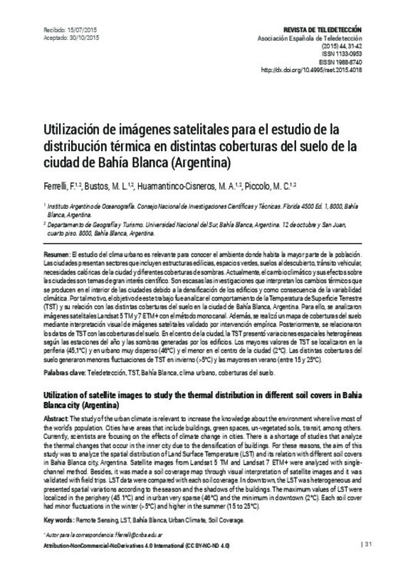
| dc.description.abstract | [EN] The study of the urban climate is relevant to increase the knowledge about the environment where live most of the world’s population. Cities have areas that include buildings, green spaces, un-vegetated soils, transit, among others. Currently, scientists are focusing on the effects of climate change in cities. There is a shortage of studies that analyze the thermal changes that occur in the inner city due to the densification of buildings. For these reasons, the aim of this study was to analyze the spatial distribution of Land Surface Temperature (LST) and its relation with different soil covers in Bahia Blanca city, Argentina. Satellite images from Landsat 5 TM and Landsat 7 ETM + were analyzed with singlechannel method. Besides, it was made a soil coverage map through visual interpretation of satellite images and it was validated with field trips. LST data were compared with each soil coverage. In downtown, the LST was heterogeneous and presented spatial variations according to the season and the shadows of the buildings. The maximum values of LST were localized in the periphery (45.1°C) and in urban very sparse (46°C) and the minimum in downtown (2°C). Each soil cover had minor fluctuations in the winter (>5°C) and higher in the summer (15 to 25°C). | es_ES |
| dc.description.abstract | [ES] El estudio del clima urbano es relevante para conocer el ambiente donde habita la mayor parte de la población. Las ciudades presentan sectores que incluyen estructuras edilicias, espacios verdes, suelos al descubierto, tránsito vehicular, necesidades calóricas de la ciudad y diferentes coberturas de sombras. Actualmente, el cambio climático y sus efectos sobre las ciudades son temas de gran interés científico. Son escasas las investigaciones que interpretan los cambios térmicos que se producen en el interior de las ciudades debido a la densificación de los edificios y como consecuencia de la variabilidad climática. Por tal motivo, el objetivo de este trabajo fue analizar el comportamiento de la Temperatura de Superficie Terrestre (TST) y su relación con las distintas coberturas del suelo en la ciudad de Bahía Blanca, Argentina. Para ello, se analizaron imágenes satelitales Landsat 5 TM y 7 ETM+ con el método monocanal. Además, se realizó un mapa de coberturas del suelo mediante interpretación visual de imágenes satelitales validado por intervención empírica. Posteriormente, se relacionaron los datos de TST con las coberturas del suelo. En el centro de la ciudad, la TST presentó variaciones espaciales heterogéneas según las estaciones del año y las sombras generadas por los edificios. Los mayores valores de TST se localizaron en la periferia (45,1°C) y en urbano muy disperso (46°C) y el menor en el centro de la ciudad (2°C). Las distintas coberturas del suelo generaron menores fluctuaciones de TST en invierno (>5°C) y las mayores en verano (entre 15 y 25°C). | es_ES |
| dc.description.sponsorship | Los autores desean agradecer al United Stated Geological Survey (USGS) por brindar la información satelital. Al Servicio Meteorológico Nacional (SMN), al Centro de Recursos Renovables de la Zona Semiárida (CERZOS) por los datos meteorológicos utilizados en esta investigación y al Centro de Investigaciones Científicas y Técnicas (CONICET, Argentina) y a la Universidad Nacional del Sur (UNS) por el financiamiento del presente trabajo. | |
| dc.language | Español | es_ES |
| dc.publisher | Universitat Politècnica de València | |
| dc.relation.ispartof | Revista de Teledetección | |
| dc.rights | Reconocimiento - No comercial - Sin obra derivada (by-nc-nd) | es_ES |
| dc.subject | Teledetección | es_ES |
| dc.subject | TST | es_ES |
| dc.subject | Bahía urbana | es_ES |
| dc.subject | Clima urbano | es_ES |
| dc.subject | Coberturas del suelo | es_ES |
| dc.subject | Remote sensing | es_ES |
| dc.subject | Urban climate | es_ES |
| dc.subject | Soil coverage | es_ES |
| dc.title | Utilization of satellite images to study the thermal distribution in different soil covers in Bahia Blanca city (Argentina) | es_ES |
| dc.title.alternative | Utilización de imágenes satelitales para el estudio de la distribución térmica en distintas coberturas del suelo de la ciudad de Bahía Blanca (Argentina) | es_ES |
| dc.type | Artículo | es_ES |
| dc.date.updated | 2017-05-04T08:47:20Z | |
| dc.identifier.doi | 10.4995/raet.2015.4018 | |
| dc.rights.accessRights | Abierto | es_ES |
| dc.description.bibliographicCitation | Ferrelli, F.; Bustos, ML.; Huamantinco-Cisneros, MA.; Piccolo, MC. (2015). Utilization of satellite images to study the thermal distribution in different soil covers in Bahia Blanca city (Argentina). Revista de Teledetección. (44):31-42. https://doi.org/10.4995/raet.2015.4018 | es_ES |
| dc.description.accrualMethod | SWORD | es_ES |
| dc.relation.publisherversion | https://doi.org/10.4995/raet.2015.4018 | es_ES |
| dc.description.upvformatpinicio | 31 | es_ES |
| dc.description.upvformatpfin | 42 | es_ES |
| dc.type.version | info:eu-repo/semantics/publishedVersion | es_ES |
| dc.description.issue | 44 | |
| dc.identifier.eissn | 1988-8740 | |
| dc.contributor.funder | Consejo Nacional de Investigaciones Científicas y Técnicas, Argentina | |
| dc.contributor.funder | Universidad Nacional del Sur, Argentina |


