JavaScript is disabled for your browser. Some features of this site may not work without it.
Buscar en RiuNet
Listar
Mi cuenta
Estadísticas
Ayuda RiuNet
Admin. UPV
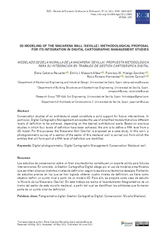
3D modeling of the Macarena Wall (Seville). Methodological proposal for its integration in digital cartographic management studies
Mostrar el registro sencillo del ítem
Ficheros en el ítem
| dc.contributor.author | Cabrera-Revuelta, Elena
|
es_ES |
| dc.contributor.author | Mascort-Albea, Emilio J.
|
es_ES |
| dc.contributor.author | Hidalgo-Sánchez, Francisco M.
|
es_ES |
| dc.contributor.author | Romero-Hernández, Rocío
|
es_ES |
| dc.contributor.author | Canivell, Jacinto
|
es_ES |
| dc.coverage.spatial | east=-5.9868421; north=37.4021063; name=Muralla medieval, Sevilla, Espanya | es_ES |
| dc.date.accessioned | 2021-07-06T10:14:21Z | |
| dc.date.available | 2021-07-06T10:14:21Z | |
| dc.date.issued | 2021-06-30 | |
| dc.identifier.issn | 1888-8143 | |
| dc.identifier.uri | http://hdl.handle.net/10251/168831 | |
| dc.description.abstract | [EN] Conservation studies of an architectural asset constitute a solid support for future interventions. In particular, Digital Cartographic Management advocates the use of simplified models that allow different levels of definition to be achieved, depending on the desired architectural scale. Based on previous studies in which four levels of definition have been achieved, the aim is to define a fifth level from a 3D model. For this purpose, the Macarena Wall (Seville) is proposed as a case study. In this work, a photogrammetric survey of a section of the sector of this medieval wall is carried out, from which the entities that will form part of a fifth level of definition are identified. | es_ES |
| dc.description.abstract | [ES] Los estudios de conservación sobre un bien arquitectónico constituyen un soporte sólido para futuras intervenciones. En concreto, la Gestión Cartográfica Digital aboga por el uso de modelos simplificados que permiten alcanzar distintos niveles de definición, según la escala arquitectónica deseada. Partiendo de estudios previos en los que se han logrado obtener cuatro niveles de definición, se tiene como objetivo definir un quinto nivel a partir de un modelo 3D. Para ello, se propone como caso de estudio la Muralla de La Macarena (Sevilla). En este trabajo se realiza el levantamiento fotogramétrico de un tramo del sector de esta muralla medieval, a partir del cual se identifican las entidades que formarán parte de un quinto nivel de definición. | es_ES |
| dc.description.sponsorship | Los autores expresan su agradecimiento a la Gerencia de Urbanismo del Ayuntamiento de Sevilla, especialmente al Servicio de Conservación Urbana y Renovación de la Edificación, al Servicio de Planeamiento y Desarrollo Urbanístico y a la Infraestructura de Datos Espaciales de Sevilla (IDE Sevilla). | es_ES |
| dc.language | Inglés | es_ES |
| dc.publisher | Universitat Politècnica de València | es_ES |
| dc.relation.ispartof | EGE Revista de Expresión Gráfica en la Edificación | es_ES |
| dc.rights | Reconocimiento (by) | es_ES |
| dc.subject | Fotogrametría digital | es_ES |
| dc.subject | Gestión Cartográfica Digital | es_ES |
| dc.subject | Conservación | es_ES |
| dc.subject | Muralla Medieval | es_ES |
| dc.subject | Digital photogrammetry | es_ES |
| dc.subject | Digital Cartographic Management | es_ES |
| dc.subject | Conservation | es_ES |
| dc.subject | Medieval wall | es_ES |
| dc.title | 3D modeling of the Macarena Wall (Seville). Methodological proposal for its integration in digital cartographic management studies | es_ES |
| dc.title.alternative | Modelado 3D de la muralla de la Macarena (Sevilla). Propuesta metodológica para su integración en trabajos de gestión cartográfica digital | es_ES |
| dc.type | Artículo | es_ES |
| dc.identifier.doi | 10.4995/ege.2021.15584 | |
| dc.rights.accessRights | Abierto | es_ES |
| dc.description.bibliographicCitation | Cabrera-Revuelta, E.; Mascort-Albea, EJ.; Hidalgo-Sánchez, FM.; Romero-Hernández, R.; Canivell, J. (2021). 3D modeling of the Macarena Wall (Seville). Methodological proposal for its integration in digital cartographic management studies. EGE Revista de Expresión Gráfica en la Edificación. 0(14):4-23. https://doi.org/10.4995/ege.2021.15584 | es_ES |
| dc.description.accrualMethod | OJS | es_ES |
| dc.relation.publisherversion | https://doi.org/10.4995/ege.2021.15584 | es_ES |
| dc.description.upvformatpinicio | 4 | es_ES |
| dc.description.upvformatpfin | 23 | es_ES |
| dc.type.version | info:eu-repo/semantics/publishedVersion | es_ES |
| dc.description.volume | 0 | es_ES |
| dc.description.issue | 14 | es_ES |
| dc.identifier.eissn | 2605-082X | |
| dc.relation.pasarela | OJS\15584 | es_ES |
| dc.description.references | Alshawabkeh, Y., El-Khalili, M., Almasri, E., Bala'awi, F., & Al-Massarweh, A. 2020. Heritage documentation using laser scanner and photogrammetry. The case study of Qasr Al-Abidit, Jordan. Digital Applications in Archaeology and Cultural Heritage, vol. 16, e00133. https://doi.org/10.1016/j.daach.2019.e00133 | es_ES |
| dc.description.references | Angulo, R., Pinto, F., Rodríguez, J., & Palomino, A. 2017. Digital Anastylosis of the Remains of a Portal by Master Builder Hernán Ruiz: Knowledge Strategies, Methods and Modelling Results. Digital Applications in Archaeology and Cultural Heritage, vol. 7 (March), pp. 32-41. https://doi.org/10.1016/j.daach.2017.09.003 | es_ES |
| dc.description.references | Barrera, J.A., Macías, D.H., & Boquera, J.H. 2005. La muralla almohade de Sevilla: aplicación de tecnologías de vanguardia a los levantamientos en arqueología y restauración. Aparejadores: Boletín Del Colegio Oficial de Aparejadores y Arquitectos Técnicos de Sevilla, no. 69, p. 48. | es_ES |
| dc.description.references | Barrera Vera, J.A. 2005. Generation of virtual models of historical tapial 1 walls in Seville (Spain). | es_ES |
| dc.description.references | Benavides López, J.A., & Barrera Vera, J A. 2020. Evaluación de los Sistemas de Mapeo Móvil (MMS) en la documentación gráfica del tholo de El Romeral (Conjunto Arqueológico Dólmenes de Antequera). Arqueología de la Arquitectura, vol. 17, e095. https://doi.org/10.3989/arq.arqt.2020.004 | es_ES |
| dc.description.references | Cabeza Méndez, J.M. 1993. Restauración de las murallas de Sevilla. Arquitectura y Ciudad II y III: Seminarios celebrados en Melilla, los días 25, 26 y 27 de septiembre de 1990 y los días 24, 25 y 26 de septiembre de 1991, pp. 341-348. | es_ES |
| dc.description.references | Cabrera-Revuelta, E., & Molero-Alonso, B. 2016. Fotogrametría terrestre. Trabajos previos a la toma de datos. EGE Revista de Expresión Gráfica en la Edificación, no. 9, pp. 33-44. https://doi.org/10.4995/ege.2016.12458 | es_ES |
| dc.description.references | Cabrera-Revuelta, E., Chávez, M.J., Barrera-Vera, J.A., Fernández-Rodríguez, Y., & Caballero Sánchez, M. 2021. Optimization of laser scanner positioning networks for architectural surveys through the design of genetic algorithms. Measurement, vol. 174, 108898. https://doi.org/10.1016/j.measurement.2020.108898 | es_ES |
| dc.description.references | Calama, J.M., & Canivell, J. 2006. Análisis patológico de los paramentos de la muralla almohade de Sevilla (tramo comprendido entre la Puerta de la Macarena y el Jardín del Valle). V SIACOT. I SAACT. Construir con Tierra. Ayer y Hoy. Libro de Resúmenes. 14-17 june 2006, Mendoza, Argentina, pp. 117-118. | es_ES |
| dc.description.references | Canivell, Jacinto et al. 2020. "A Methodological Framework for the Preventive Conservation of Historic Walls Located in Urban Contexts. Spatial Data Standards for the Medieval Wall of Seville (Spain): The Case of the Macarena Sector." Ge-Conservacion 18(1): 44-55. https://doi.org/10.37558/gec.v18i1.762 | es_ES |
| dc.description.references | Canivell, J., Jaramillo-Morilla, A., Mascort-Albea, E.J., & Romero-Hernández, R. 2019. Metodología de evaluación y monitorización del patrimonio basado en la gestión cartográfica digital. La muralla de Sevilla. In M.D. Sivo, D. Ladiana (Ed.), Le Mura Urbane Crollano: Conservazione e Manutenzione Programmata Della Cinta Muraria Dei Centri Storici: Atti del Seminario Internazionale.(pp. 119-135). Pisa: Pisa University Press. https://hdl.handle.net/11441/88061 | es_ES |
| dc.description.references | Canivell, J., Mascort-Albea, E.J., Cabrera-Revuelta, E., Romero-Hernández, R., Jaramillo-Morilla, A., & Serrano-Chacón, Á. 2020. A methodological framework for the preventive conservation of historic walls located in urban contexts. Spatial data standards for the medieval wall of Seville (Spain): the case of the Macarena sector. Ge-Conservacion, vol. 18, no. 1, pp. 44-55. https://doi.org/10.37558/gec.v18i1.762 | es_ES |
| dc.description.references | Chiabrando, F., Colucci, E., Lingua, A., Matrone, F., Noardo, F., & Spanòa, A. 2018. A European Interoperable Database (EID) to increase resilience of cultural heritage. International Archives of the Photogrammetry, Remote Sensing and Spatial Information Sciences, vol. 42, no. 3/W4, pp. 151-158. https://doi.org/10.5194/isprs-archives-XLII-3-W4-151-2018 | es_ES |
| dc.description.references | Henriques, F., Bailão, A., Rocha, J., & Costa, J. 2020. Restoration of an 18th century frame: 3D modelling, printing and matching color of decorative flowers elements. Ge-Conservacion, vol. 18, no. 1, pp. 313-322. https://doi.org/10.37558/gec.v18i1.854 | es_ES |
| dc.description.references | Hidalgo-Sánchez, F.M. 2018. Interoperatividad entre SIG y BIM aplicada al patrimonio arquitectónico, exploración de posibilidades mediante la realización de un modelo digitalizado de la Antigua Iglesia de Santa Lucía y posterior análisis. Final Degree Work. Universidad de Sevilla, Sevilla. https://hdl.handle.net/11441/79394 | es_ES |
| dc.description.references | Jiménez-Maqueda, D., & Pérez-Quesada, P. 2012. La muralla huérfana. A vueltas con el último recinto amurallado de Madnat Išblia. Romula, no. 11, pp. 273-347. López-Martínez, F.J. 1999. Tapias y tapiales. Loggia: Arquitectura y Restauración, no. 8, pp. 74-89. https://doi.org/10.4995/loggia.1999.5288 | es_ES |
| dc.description.references | Martín-del-Río, J.J., Alejandre, F.J., Blasco-López, F.J., & Márquez-Martínez, G. 2008. Hormigones de cal islámicos: altas resistencias en los tapiales del sector oriental de la Muralla de Sevilla (España). Actas de IX CICOP 2008. Congreso Internacional de Rehabilitación del Patrimonio Arquitectónico y Edificación. Patrimonio Construido e Innovación., Sevilla, vol. I, pp. 81-86. | es_ES |
| dc.description.references | Masciotta, M.G., Morais, M.J., Ramos, L.F., Oliveira, D.V, Sánchez-Aparicio, L.J., & González-Aguilera, D. 2019. A Digital-based Integrated Methodology for the Preventive Conservation of Cultural Heritage: The Experience of HeritageCare Project. International Journal of Architectural Heritage, pp. 1-20. https://doi.org/10.1080/15583058.2019.1668985 | es_ES |
| dc.description.references | Mascort-Albea, E.J., Jaramillo-Morilla, A., Romero-Hernández, R., & Hidalgo-Sánchez, F.M. 2020. BIM-GIS interoperability applied to architectonic heritage: 2D and 3D digital models for the study of the ancient church of Santa Lucía in Seville (Spain). Science and Digital Technology for Cultural Heritage: Interdisciplinary Approach to Diagnosis, Vulberability, Risk Assessment and Graphic Information Models, CRC Press. pp. 31-35. https://doi.org/10.1201/9780429345470-5 | es_ES |
| dc.description.references | Merchán, M.J., & Pérez, E. 2020. Conservation to overcome oblivion. New methods for the survival of lost heritage memory. Ge-Conservacion, no. 17, pp. 160-170. https://doi.org/10.37558/gec.v17i1.753 | es_ES |
| dc.description.references | Piaia, E., Maietti, F., Di Giulio, R., Schippers-Trifan, O., Van Delft, A., Bruinenberg, S., & Olivadese, R. 2020. BIM-based cultural heritage asset management tool. Innovative solution to orient the preservation and valorization of historic buildings. International Journal of Architectural Heritage, pp. 1-24. https://doi.org/10.1080/15583058.2020.1734686 | es_ES |
| dc.description.references | Pierdicca, R. 2018. Mapping Chimu's settlements for conservation purposes using UAV and close range photogrammetry. The virtual reconstruction of Palacio Tschudi, Chan Chan, Peru. Digital Applications in Archaeology and Cultural Heritage, vol. 8, pp. 27-34. https://doi.org/10.1016/j.daach.2017.11.004 | es_ES |
| dc.description.references | Quattrini, R., Pierdicca, R., Paolanti, M., Clini, P., Nespeca, R., & Frontoni, E. 2020. Digital interaction with 3D archaeological artefacts: evaluating user's behaviours at different representation scales. Digital Applications in Archaeology and Cultural Heritage, vol. 18, e00148. https://doi.org/10.1016/j.daach.2020.e00148 | es_ES |
| dc.description.references | Rubio, J.M., Martín, J.J.F., & Alonso, J.I.S.J. 2018. Implementation of 3D scanner and digital photogrammetry in the documentation process of la Merced Church, Panama. EGA Revista de Expresion Grafica Arquitectonica, vol. 23, no. 32, pp. 208-219. https://doi.org/10.4995/ega.2018.9811 | es_ES |
| dc.description.references | Sequenzia, G., Fatuzzo, G., & Oliveri, S.M. 2021. A computer-based method to reproduce and analyse ancient series-produced moulded artefacts. Digital Applications in Archaeology and Cultural Heritage, vol. 20, e00174. https://doi.org/10.1016/j.daach.2021.e00174 | es_ES |


