


Listar por palabra clave "Cartography"
RiuNet: Repositorio Institucional de la Universidad Politécnica de Valencia
- RiuNet repositorio UPV
- :
- Listar por palabra clave
JavaScript is disabled for your browser. Some features of this site may not work without it.
Buscar en RiuNet
Listar
Mi cuenta
Ayuda RiuNet
Admin. UPV
Listar por palabra clave "Cartography"
Mostrando ítems 41-60 de 96
-
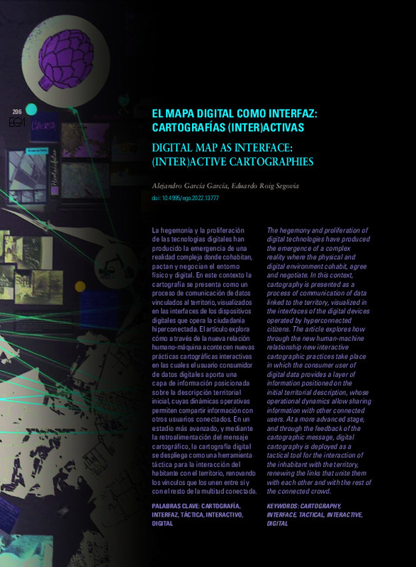 Garcia Garcia, Alejandro; Roig Segovia, Eduardo (Universitat Politècnica de València, 2022-07-15)[EN] The hegemony and proliferation of digital technologies have produced the emergence of a complex reality where the physical and digital environment cohabit, agree and negotiate. In this context, cartography is presented ...
 -
 Valero Hoyo, Vanesa (Universitat Politècnica de València, 2023-03-06)[ES] La representación del territorio ha suscitado un gran interés en los artistas a lo largo de la historia. El principal objetivo de esta investigación consiste en estudiar la relación entre el mapa y la producción de ...
 -
 Domingo Gresa, Jorge (Universitat Politècnica de València, 2014-05-15)[EN] Pursuant to the Royal Order of July 25, 1946, issued by the Ministry of Government, the Council Architect of Alicante Emilio Jover Pierron made the General Plan of the city of Alicante. His work, which started immediately ...
 -
 Barra, Anna; Colell, Xavier; Echeverria, Anna; Trapero, Laura; Marturia, Jordi; Fabregat, Ivan; Gao, Qi; Cuevas, María; Gasc, Muriel; Buxó, Pere; Dufour, Nathalie; Luzi, Guido; Crosetto, Michele (Editorial Universitat Politècnica de València, 2021-10-01)[EN] The objective of the POCTEFA - MOMPA project (Monitoring of Ground Movements and Action Protocol) is to provide a useful technical-operational tool for the prevention and management of risks due to slope movements, ...
 -
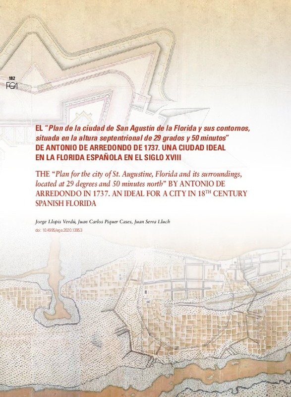 Llopis Verdú, Jorge; Piquer Cases, Juan Carlos; Serra Lluch, Juan de Ribera (Universitat Politècnica de València, 2020-07-22)[ES] El siglo XVIII verá, con la instauración del real cuerpo de ingenieros militares en el año 1711, el advenimiento de una nueva figura que transformará las características gráficas de la cartografía española. El ingeniero ...
 -
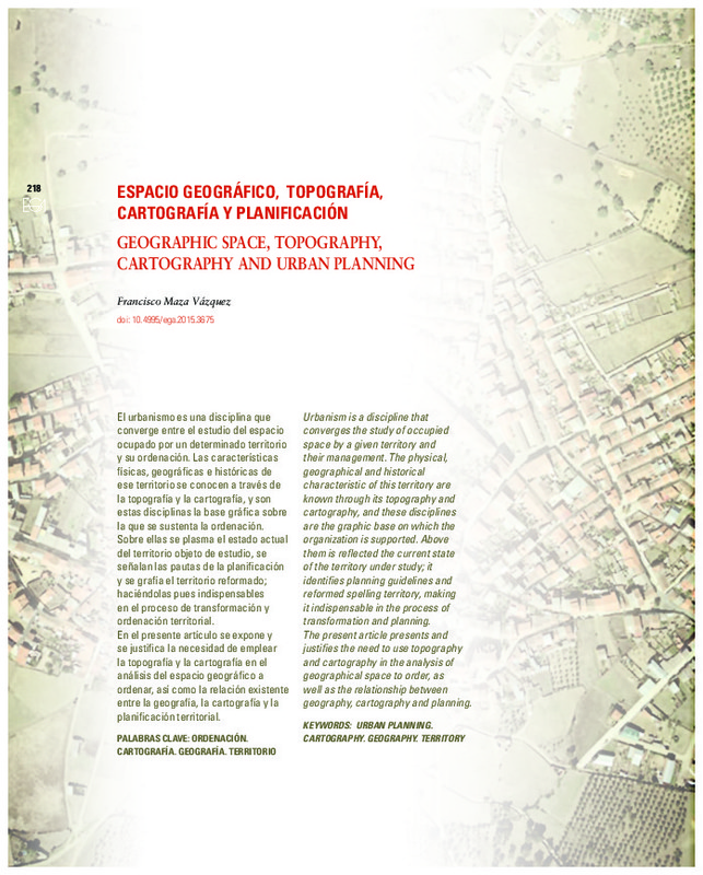 Maza Vázquez, Francisco (Universitat Politècnica de València, 2015-06-22)[EN] Urbanism is a discipline that converges the study of occupied space by a given territory and their management. The physical, geographical and historical characteristic of this territory are known through its topography ...
 -
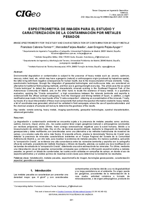 Espectrometría de imagen para el estudio y caracterización de la contaminación por metales pesados Cabrera-Torres, Francisco; Farjas-Abadía, Mercedes; Rejas-Ayuga, Juan (Editorial Universitat Politècnica de València, 2021-10-01)[EN] Environmental degradation or contamination is subject to the presence of heavy metals such as: arsenic, cadmium, mercury, nickel, lead, etc., which may have a geogenic (natural) or anthropogenic origin (produced by ...
 -
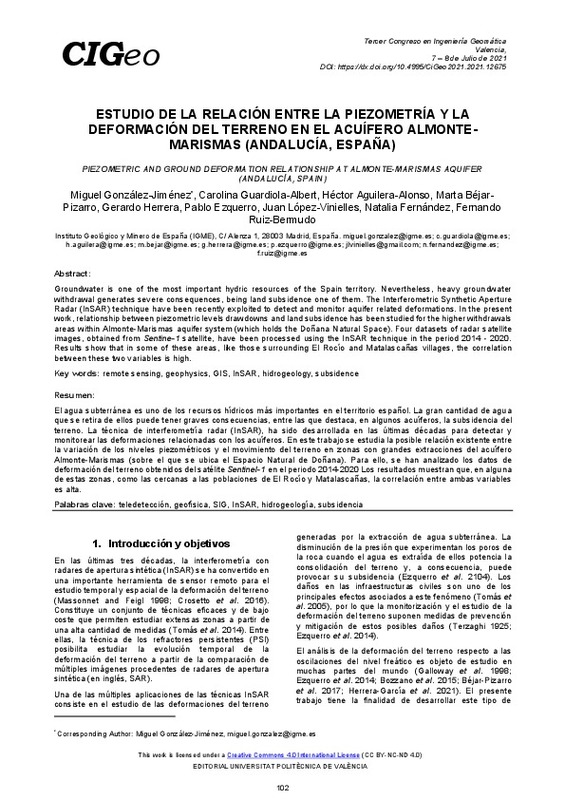 González-Jiménez, Miguel; Guardiola-Albert, Carolina; Aguilera-Alonso, Héctor; Béjar- Pizarro, Marta; Herrera, Gerardo; Ezquerro, Pablo; López-Vinielles, Juan; Fernández, Natalia; Ruiz-Bermudo, Fernando (Editorial Universitat Politècnica de València, 2021-10-01)[EN] Groundwater is one of the most important hydric resources of the Spain territory. Nevertheless, heavy groundwater withdrawal generates severe consequences, being land subsidence one of them. The Interferometric ...
 -
 Ivaylova Ilieva, Tereza (Universitat Politècnica de València, 2017-09-04)[ES] En el presente documento se realiza un análisis de las Infraestructuras de Datos Espaciales de España enfocado a conocer con detenimiento las diferencias entre las diferentes Infraestructuras de Datos Espaciales a ...
 -
 Cabanillas Domingo, Víctor (Universitat Politècnica de València, 2021-10-06)[ES] Se realiza un estudio de paisaje de acuerdo con la Ley 5/2014, de julio, de Ordenación del Territorio, Urbanismo y Paisaje, de la Comunitat Valenciana, que tiene como objetivo establecer criterios para zonificar los ...
 -
 Femenia-Ribera, Carmen; Mora Navarro, Joaquin Gaspar; Santos Pérez, Luis J. (Elsevier, 2022-03)[EN] The old cadastral maps of the Spanish General Directorate for Cadastre (DGC) have always been in great demand. It was decided in 2012 to make an initial inventory of these maps with the type of information available, ...
 -
 Sabariego Uceda, Fran (Universitat Politècnica de València, 2021-12-31)[EN] Rural drift, radioactive effects on the genome and cartography as an artistic practice are the concepts that intersect this research located in Andújar ( Jaén), a place where the different problems that arise from the ...
 -
 Femenía Ribera, Carmen; Mora Navarro, Joaquin Gaspar; Martínez Llario, José Carlos; Coll Aliaga, Eloína (2012)Since the GeoBase project has used cartography, the Land Registry has reached new information technologies. This way, some new procedures and software for the edition, storage and analysis of the graphical information ...
 -
 Rodrigo-Comino, Jesús; Terol, Enric; Cerdà, Artemi (Editorial Universitat Politècnica de València, 2021-10-01)[EN] Policymakers, stakeholders and rural inhabitants must be aware of the relevance of soil erosion as an irreversible landdegradation process. This is key to achieve the land degradation neutrality challenge and the ...
 -
 La Spina, Vincenzina; Mileto, Camilla; Vegas López-Manzanares, Fernando; Coll Aliaga, Peregrina Eloína (Instituto Universitario de Restauración del Patrimonio de la UPV, 2011)El estudio y la caracterización de los revestimientos continuos tradicionales del centro histórico de Valencia han permitido conocer su verdadero carácter material, el yeso, que implica la realización de una técnica ...
 -
 López López, Jorge Manuel (Universitat Politècnica de València, 2014-09-16)[EN] At the fourth century Christian monasticism leaves the anchoritic lifestyle begining a new monastic organization. These religious communities not only shows an architecture of monastic life, but it also highlights a ...
 -
 Sanchis Ibor, Carles (Universitat de Barcelona, 2012)[EN] José de Morós y Morellón wrote, between 1841 and 1847, several geographical reports linked, directly or indirectly, to the Real Sociedad Económica de Amigos del País de Valencia. His works, based on a solid education and ...
 -
 Chias Navarro, Pilar (Universitat Politècnica de València, 2018-11-27)[EN] Urban and architectural drawings, together with cartography and landscape representation, can be considered upon a wide scope. Over the centuries, maps, plans, views and sketches have shaped a graphic corpus with its ...
 -
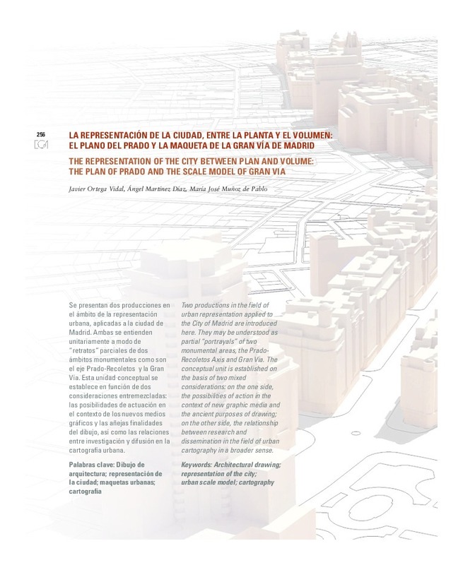 Ortega Vidal, Javier; Martínez Díaz, Ángel; Muñoz de Pablo, María José (Editorial Universitat Politècnica de València, 2012)[EN] Two productions in the field of urban representation applied to the City of Madrid are introduced here. They may be understood as partial "portrayals" of two monumental areas, the Prado-Recoletos Axis and Gran Via. ...
 -
 Femenía Ribera, Carmen (Universitat de Barcelona, 2006)El deslinde, y el posterior amojonamiento, permite delimitar de forma exacta sobre el terreno la porción del territorio perteneciente a propietarios distintos; tal como los límites que definen una servidumbre señalan ...
Mostrando ítems 41-60 de 96

Universitat Politècnica de València. Unidad de Documentación Científica de la Biblioteca (+34) 96 387 70 85 · RiuNet@bib.upv.es
El contenido de este sitio está bajo una licencia Creative Commons Reconocimiento – No Comercial – Sin Obra Derivada (by-nc-nd), salvo que se indique lo contrario.
Los metadatos de este sitio están bajo una licencia Dominio Público.
